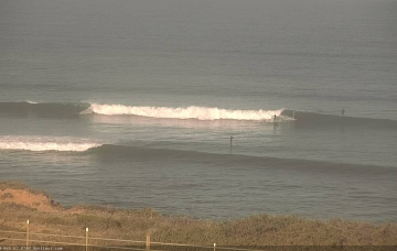
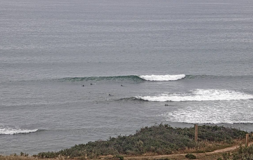
Brief mid-week windows at Victor
Monday, 25 October 2021
Strong onshore winds associated with this cut-off low are likely to dominate the start of the weekend.
There's not much to look forward to this week.
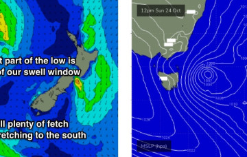
The current synoptic pattern is a low pressure system E of Tasmania directing a fetch of SSW to S strong winds to low end gales adjacent to the NSW South Coast and extending south-east of Tasmania. This low then eases as it moves out into the Tasman sea later today.
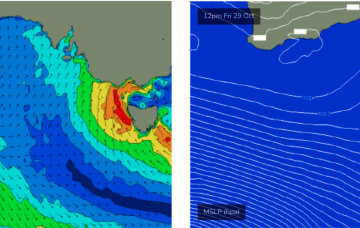
The current synoptic pattern is a low pressure system E of Tasmania directing a fetch of SSW to S strong winds to low end gales adjacent to the NSW South Coast. This low then eases as it moves out into the Tasman sea later today.
The current synoptic pattern is a low pressure system E of Tasmania directing a fetch of SSW to S strong winds to low end gales adjacent to the NSW South Coast. This low then eases as it moves out into the Tasman sea later today.
Although the core of the low will be positioned off NE Tasmania, with the strongest winds just outside the South Arm’s swell window, the fetch will reach maturity overnight Sunday and it’ll also extend a reasonable distance to the south.
Freshening SW winds this afternoon are related to a weak front crossing the coast. They’ll strengthen overnight and hold through Saturday before veering S/SE on Sunday and starting to ease back a bit.
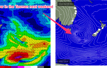
Sunday’s developing low east of Tasmania looks quite interesting, as it’ll remain slow moving, which will keep onshore winds across Victorian beaches through Monday.
Next week still looks like being marred by a constant onshore flow until Thursday as a node of the long wave trough directs weak fronts into the SW.