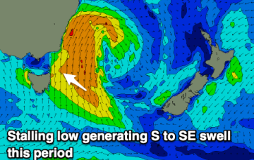
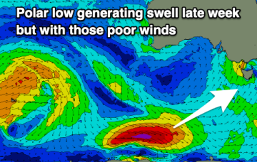
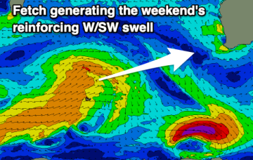
Stacks of sustained swell from the south, and a peak from the east
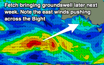
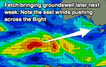
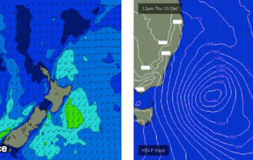
There's no evidence to suggests any deviation away from the current regional trend for the east swell.
A reintensification of the Tasman Low on Saturday and Sunday - further east, near New Zealand - will generate a renewal of strong S/SE thru SE swell for Monday.
The coming period looks fun with plenty of swell (small to tiny Mandurah/Perth) and with morning offshore winds.
A good new groundswell is expected tomorrow but with morning E winds, improving as the swell eases Sunday. Next week looks slow.
A good sized SW groundswell is due into tomorrow, easing thereafter with persistent, gusty east to south-east winds.
The main synoptic feature for the short term period is a developing complex Tasman Low that'll spin up east of Bass Strait overnight, and reach peak intensity on Friday, but actually remain active within our swell window until next Wednesday.
That's right, we're looking at a week of waves from a single swell source.
Windy, cold and with persistent swell energy from the south-eastern quadrant.
Plenty of swell but terrible conditions and weather for the coming days.
The surf will bottom out tomorrow morning but increase from there, with fun swells due from the afternoon through most of next week.