Surf on the small side but conditions look good
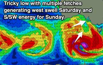
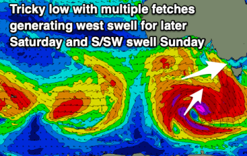
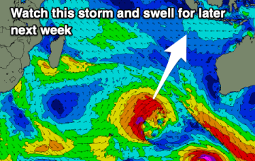
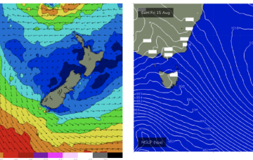
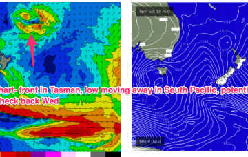
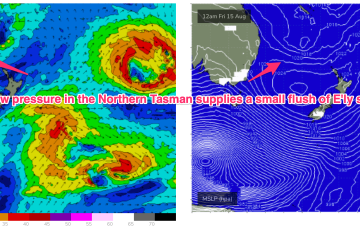
The trough forms a broad surface low that briefly flares up as it drifts towards the North Island and interacts with a more tropical derived low.
A fun new west swell on the Mid Coast this afternoon is worth making the most of before windier conditions kick in from tomorrow.
The weekend outlook still remains slightly fluid so check back on Friday for one more look at it. Next week will become fun across the beaches again.
Slow, easing week, with more swell potential later next week.
Good news though for next week with another powerful high expected to move through the Bight and set up a strong ridge up the QLD coast and deep E’ly-SE’ly flow through the Coral Sea.
The weekend’s fronts and lows sweeping up from the south look to consolidate early next week into a much stronger system, backed by a strong high in the Bight.
The swell from last week is bottoming out with nothing of significance on the way until the weekend.
As noted on Fridays forecast another unseasonal low pressure system formed off the QLD coast over the weekend and has now drifted over to a position roughly equidistant between New Caledonia and the North Island.
There's been no improvement to the outlook with a couple of windows to the north and one in the South West come the weekend.
Once again, we’re in a position of enhanced instability in the Tasman and Coral Seas with models really struggling to resolve the troughiness.