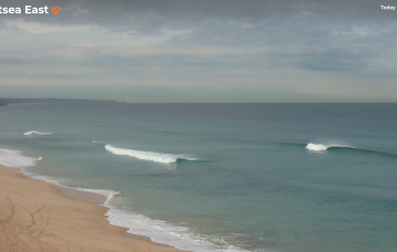
Quality E swells continue with winds turning W'ly through the week
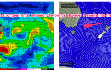
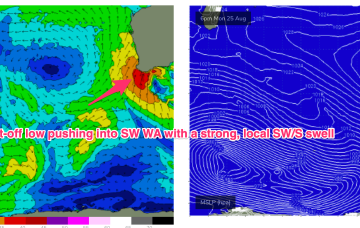
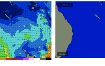
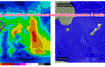
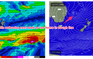
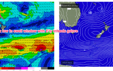
These low centres are focussing areas of E’ly infeed along the trough line- perfectly aimed at east coast targets.
A deep Southern Ocean low well to the SW of West Oz today is setting up a better long period groundswell that’ll arrive on Monday morning, and peak late in the day before easing through Tuesday.
Saturday’s looking really fun across both coasts.
The next swell generated by a compact but storm force low tracking from Heard Is towards WA fills in Sun.
Although we’re still some time away from the inbound W’ly swell to reach Cape Sorell, there are some other upstream data points that can assist in the decision making process.
High pressure is now moving away and the fetch in the Coral Sea is expected to ease over the weekend and migrate south and eastwards.
Surf-wise, whatever configuration of low pressure we end up getting, a broad E’ly infeed in the Southern Coral Sea and Northern Tasman as well as one off the South Coast aimed at Tasmania will generate plenty of E/NE’ly swell into early-mid week.
Surf-wise, whatever configuration of low pressure we end up getting, a broad E’ly infeed in the Southern Coral Sea and Northern Tasman will generate plenty of E’ly swell into early-mid week.
Plenty of chunky short range S swell through Sun as the low generates a proximate fetch of S’ly low end gales along the south coast to Hunter.