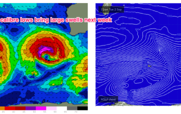
Classic week of spring swells ahead 
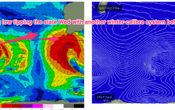
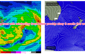
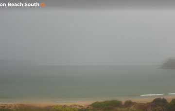
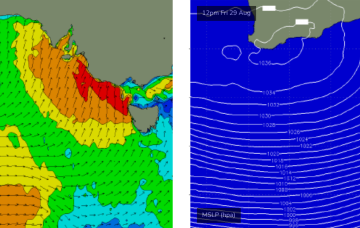
A vigorous low and cold front will cross Bass Strait overnight tonight, bringing gale to storm force SW winds across the entire Victorian coast.
Plenty of energy through Tues and into Wed generated by rolling disturbances and a long zonal fetch in the screaming 50’s over the weekend .
Next weeks high pressure centre in the Tasman now looks weaker and the trade flow in the Coral Sea is weaker and more disjointed.
Still on track for a wintry blast this weekend as a strong cold front tied to an intense low currently west of Tasmania sweeps up over the SE overnight and enters the Tasman early tomorrow morning.
I’m still not holding my breath for the next few days.
The system intensifies to storm forces status Sun/Mon as it tracks NE towards the SW corner, generating large swells for Wed.
We’ve got a powerful winter swell event bearing down on the coast, with very large waves expected to develop Friday.
Let’s not be distracted by the weekend’s main event - there are some OK waves on the way for Thursday.