Large and windy for a couple of days, then a spell of small surf
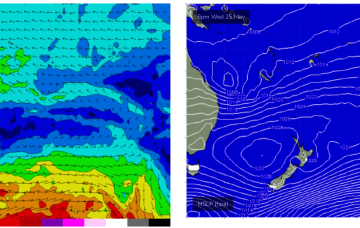
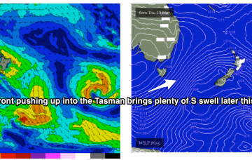
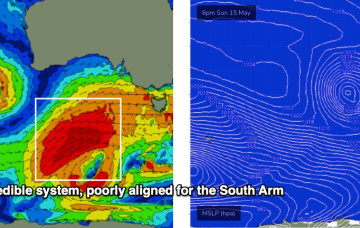
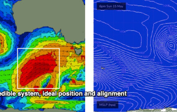
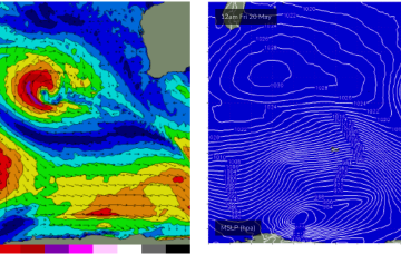
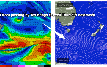
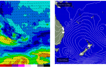
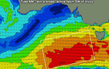
So, here we are, on the cusp of a major winteresque swell (and weather) pattern.
More E swell and SE winds into the medium term as the high sets up another trade flow through the Coral Sea. This will see increasing surf through the CQ region from Fri becoming chunky next week.
Stronger fronts push up into the Tasman from later Wed, bringing a S'ly flow and bigger S swell as we head to the end of the week.
Stronger fronts push up into the Tasman from later Wed, bringing a SW flow and bigger S swell as we head to the end of the week.
These lows will coalesce to form a large primary system by Sunday, but the resulting swell will still be too westerly for the South Arm on Monday.
There’s a whole stack of swell on the way too, though initially it’ll be very westerly in direction, originating from a powerful low spinning up immediately south of West Oz that’ll drive a strong front through the Bight.
TThe associated fetch is lining up in the best part of the Vicco swell window (relative to surf size and consistency), and will remain slow moving as it reaches maturity, drawn out over an impressive 30-odd hours or so, which helps to exaggerate eventual surf size above the usual model expectations. It's not a common event.
Into next week and a compact but powerful cut-off low approaches the state early next week. Early incarnations of the low aim up severe gales generating a strong W/SW pulse Tues.
Further south the NE swell is now on the wane, with some surfable leftovers on offer over the weekend.
Pumping surf across the region since the last f/cast with more to come over the weekend.