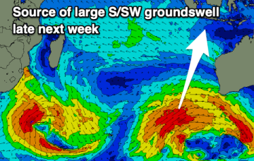
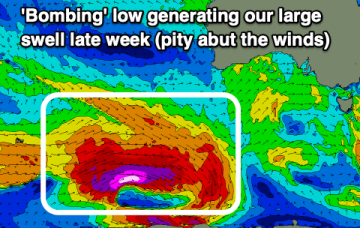
Large swell from a 'bombing' low goes to waste
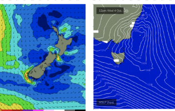
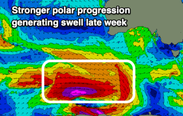
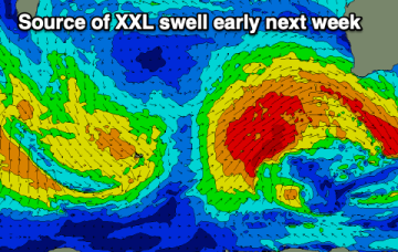
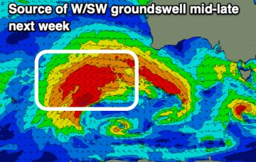
The coming period isn't great with troughy weather and onshore winds due to wreck a couple of great swells.
Mon should be the low point, possibly running into Tues before we see a modest rebuild in new E’ly tradewind swell as tradewinds reestablish across the South and Eastern Coral Seas.
Into the new week and it still looks dynamic with several strong N’ly fetches.
Make the most of tomorrow's waves before tiny surf develops. Late next week looks large but onshore.
We've got a poor few days of surf with an XL swell for early next week, improving while easing into the rest of the week. A reinforcing large S/SW groundswell is also due late week.
We’ve got a strong, expansive front passing through the Tasman at present will which supply some small pulses of S swell over the coming days. High pressure over NSW is moving NE into the Tasman, with a N’ly flow presently developing.
The South Coast is the pick of the coming days before things deteriorate into Sunday. A large W/SW and S/SW groundswell are due next week but with mostly poor winds.
We’ve got a strong, expansive front passing through the Tasman at present will which supply pulses of S swell over the coming days. High pressure over NSW is moving NE into the Tasman, with a N’ly flow developing. That N'ly flow will really intensify next week with some juicy NE windswell resulting.
Favourable winds and fun levels of swell are worth making the most of. Mid-late next week looks larger but with poor winds.
A good swell to end off the week ahead of a larger, consistent swell next week.