Upgrade in swell for Sunday/Monday but onshore
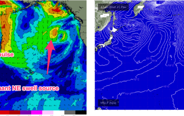
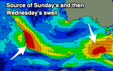
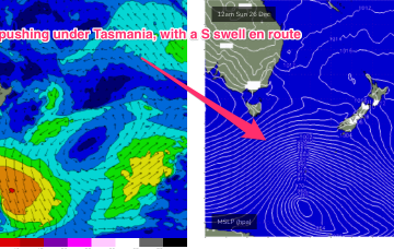
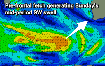
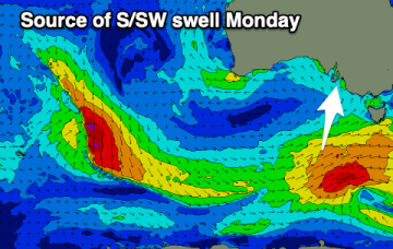
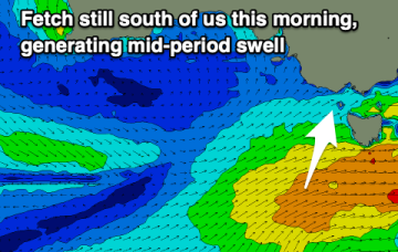
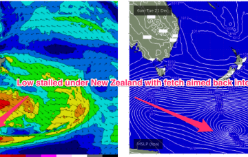
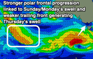
There's been an upgrade in the strength of a frontal progression bringing swell over the coming days but winds will spoil it.
A strong high drifting into the Gulf of Alaska towards the west coast is maintaining a firm ridge extending from the coast of British Columbia into the Central North Pacific, with angular spread from the predominant N’ly fetch producing a N/NE swell for Hawaii’s North Shore.
There's no lack of swell due this period but winds will be a bit all over the place and not ideal.
This swell should hold into Xmas Day, offering up potential for some good, albeit inconsistent surf with prevailing W’ly winds.
We'll see temperatures rise and winds swing slowly more offshore while strengthening but with minimal levels of swell.
Very weak pressure gradients everywhere as we continue to meander through this troughy, doldrums pattern. Plenty of action ahead next week.
Very weak pressure gradients everywhere as we continue to meander through this troughy, doldrums pattern with small, weak surf. Lots of action ahead next week.
We'll see a strong SW swell this afternoon, easing into the end of the week with one clean day down South, followed by a poor run of onshore winds.
Today's large building energy will ease into the end of the week but winds look favourable with an improved outlook.
Of more interest is a longer period SE swell being generated from well below the South Island of New Zealand Tues/Wed this week (see below)