Make the most of early tomorrow
Monday, 10 January 2022
Make the most of early tomorrow
Monday, 10 January 2022
A poor period of waves and winds with tomorrow morning looking to be the pick of a bad bunch.
A poor period of waves and winds with tomorrow morning looking to be the pick of a bad bunch.
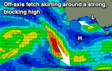
The GFS scenario sees NE winds developing in the swell window Thurs with surf building into the 3ft range. A much bigger NE swell builds Fri into the 5-6ft range. With fresh NE winds.
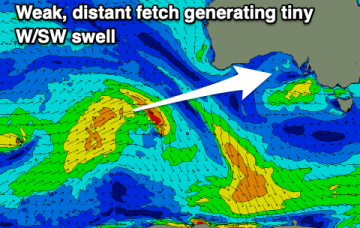
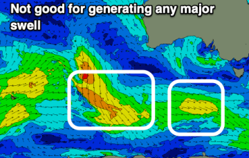
The coming forecast period and beyond remains void of any major swell activity. There'll be some fun waves on the weekend.
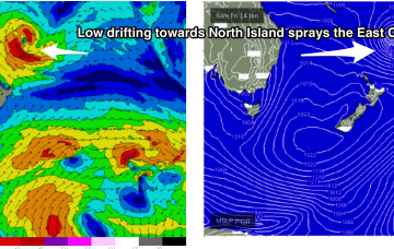
Fri should see better quality E swell coming around the corner from Fraser Island, generated by a long fetch of E’ly winds through the South Pacific as a tropical low drifts down towards New Zealand
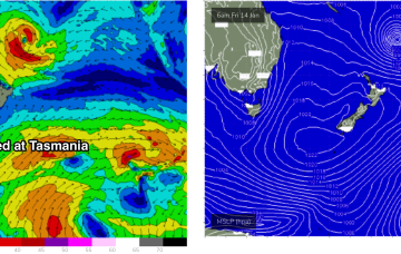
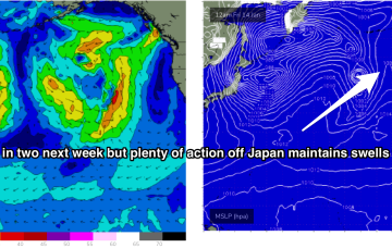
Our current synoptic pattern is typical of the season and the La Nina end of the ENSO cycle. High pressure straddles New Zealand and a tropical low now drifting south from between Fiji and Vanuatu.
Our current synoptic pattern is typical of the season and the La Nina end of the ENSO cycle. High pressure straddles New Zealand and a tropical low now is drifting south from between Fiji and Vanuatu towards the North Island.
La Niña continues to bring high pressure, now swell and persistent winds from the south-eastern quadrant.
The outlook is poor for the coming fortnight so make the most of today's swell and favourable conditions.
There’s not much let-up in the action next week. Storms have been spaced around 24-36hrs apart with each new fetch working on an already active sea state. This is producing overlapping swell trains, with consistent big surf expected across exposed North and West facing shores next week.
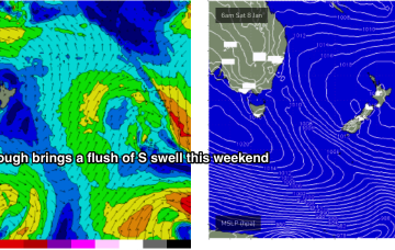
The rest of next week looks uneventful for the East Coast. A weak trough brings a slight bump in S swell Tues but its short period, weak stuff and unlikely to exceed 1-2ft.