Slow period with small windows
Friday, 1 April 2022
Slow period with small windows
Friday, 1 April 2022
No standout days with dicey winds when any swell arrives.
No standout days with dicey winds when any swell arrives.
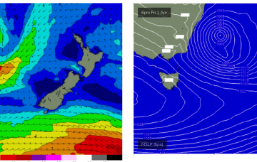
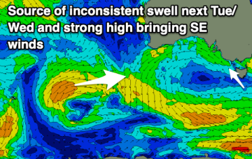
A deep Tasman low is expected to reach peak strength through this a’noon, with a general southwards movement favouring ETas, as it places the fetch wrapping into the SE quadrant within the swell window.
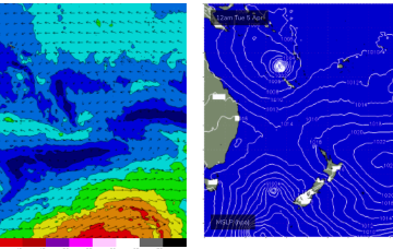
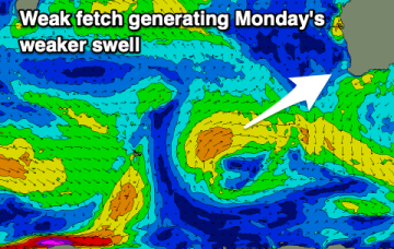
Into next week and things get a bit more juicy. A high pressure ridge and weak but long tradewind fetch extends out through the Coral Sea towards New Caledonia later this weekend and into Mon.
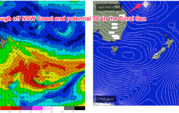
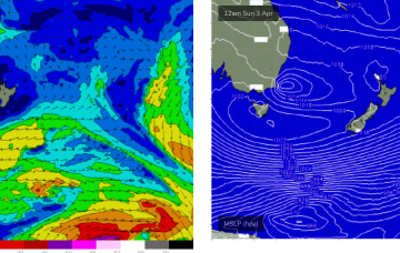
The trough off the NSW Coast is expected to deepen and in conjunction with the large high moving at Tasmanian latitudes, create a large SE to E’ly fetch aimed at NENSW and SEQLD.
That will offer a window of improving conditions at Big Wave Spots, albeit under strong offshore conditions, which will make any offshore bombies hard to ride.
It's hardly an autumn surf outlook in the early stages of the month unfortunately.
A poor forecast for autumn with no reliable, quality surf days. Better winds and swells are likely longer term.
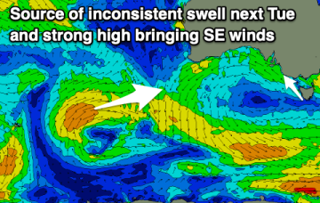
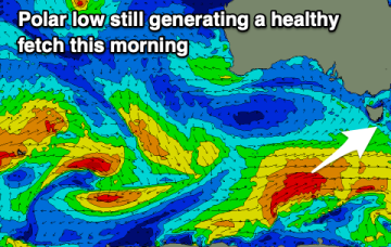
Severe gale force winds are proximate to the NSW Coast and are well placed to generate plenty of S swell for Tasmania before a better angled ESE to E swell hits on the weekend.
An unseasonal run of south to south-east winds spoil good incoming swells.
All this is too far south and behind the curve of the QLD Coast and Fraser Island to produce any surf for the CQ region, so we’ll see the tiny surf that was on offer today contract back to near flatness for the rest of the week.