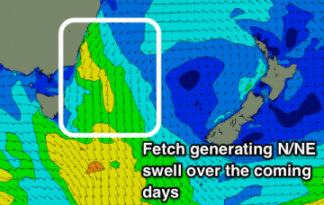
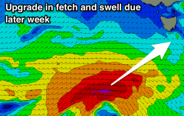
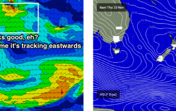
Upgrade in our N/NW groundswell due this week
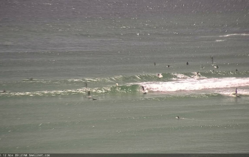
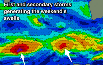
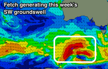
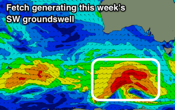
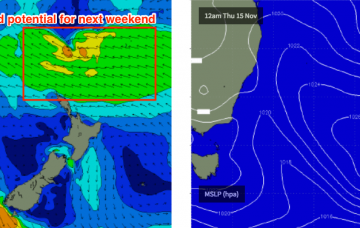
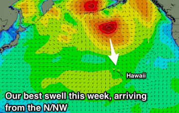
A low point in swell tomorrow morning ahead of a fun N/NW groundswell mid-late week with favourable winds. Very slow next week.
We’ve got building swells on the cards for the rest of the week, thanks to a slow moving Tasman high. The main issue we have this week are local winds.
Building windswell tomorrow, easing slowly Wednesday with winds doing a full rotation from the north-west to east.
Easing surf tomorrow and further Wednesday ahead of a good swell later week, but with dicey winds.
Over the last few days, the models have started to show some interest in a possible Tasman Low forming in the lee of the Thursday/Friday trough, and generating solid swells for the weekend.
Average swells with less than ideal winds, with one day of decent surf, otherwise average. A better swell on the weekend but at this stage onshore.
Winds start to take on a summer regime through this forecast period with less windows of clean conditions down South. Magnets look the go through the period.
Easing swell with good winds tomorrow, smaller Wednesday with a good swell to end of the week but with average to poor winds. Improving over the weekend.
A deepening trough to our north-east is expected to spawn a possible tropical cyclone by mid-week (between Vanuatu and Fiji).
Looking further to the north, and the deepening trough is expected to spawn a possible tropical cyclone by mid-week (between Vanuatu and Fiji).