Tricky west swells for the weekend, becoming more reliable from Sunday onwards
Friday, 7 July 2023
Flag tomorrow and focus on the surf and swells from Sunday. There's lots of activity to come for the coming week and a bit.
Flag tomorrow and focus on the surf and swells from Sunday. There's lots of activity to come for the coming week and a bit.
The whole archipelago is experiencing large surf with more to come.
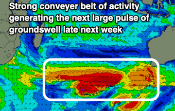
Still looking promising from mid next week as high pressure moves into the Tasman at a N'ly latitude and a SE surge builds up the QLD Coast.
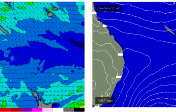
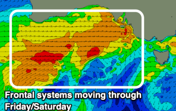
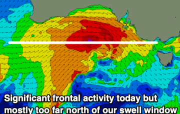
Sunday sees a strong front push through into the Tasman and a fetch of strong winds below the state should generate a fresh round of S swell to 2-3ft at S exposed breaks under strong W-W/SW winds.
Make the most of the coming days as the longer term outlook is slow.
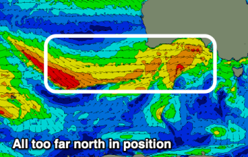
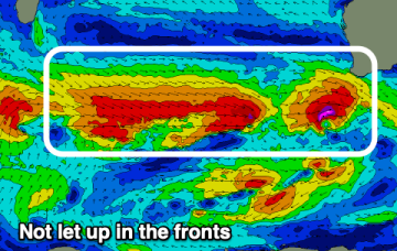
Unfortunately the outlook for the South West of the state is poor with persistent fronts, large swell pulses but no offshore windows.
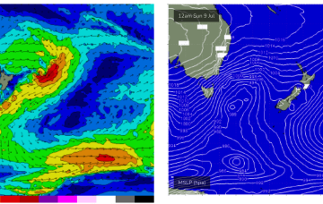
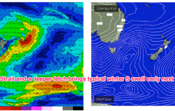
Residual S/SE groundswell pulses from the off axis fetch as it drifted slowly SE of the South Island will put a floor under wave heights before we see a fresh round of S swell early next week. Good news for some areas south of the border, with a much less exciting but seasonally expected outlook for SEQLD.
The South Coast will be the pick of the period with the cleanest conditions in this windy, frontal period.
A more typical winter pattern which we saw in June is set to return, with high pressure over the continent ridging against frontal activity with a W’ly flow extending right up to the sub-tropics. Residual S/SE groundswell pulses from the off axis fetch as it drifted slowly SE of the South Island will put a floor under wave heights before we see a fresh round of S swell early next week.
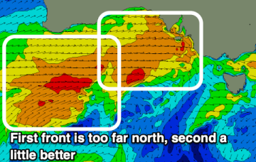
We've got an inconsistent, westerly swell due tomorrow followed by a downgrade in the weekend's swell.