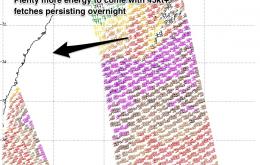
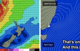
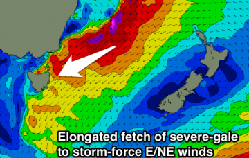
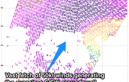
Large powerful S/SW groundswell for the coming days
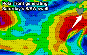
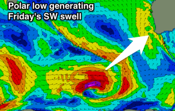
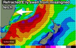
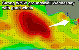
Very large and powerful S/SW groundswell building tomorrow, especially late afternoon, peaking Thursday and easing into the weekend.
E'ly swell tomorrow and Wednesday with a better W/SW groundswell in the mix for Wednesday. Large messy SW swell due to develop Saturday, cleaner and easing Sunday.
Large powerful SW groundswell peaking tomorrow morning with gusty S/SW winds, easing into the afternoon and further Wednesday with S'ly winds. Cleaner Thursday up in Perth with a new swell for Friday with decent winds.
Offshore breezes look to persist each day of the week as an E'ly swell slowly fades. S'ly groundswell due to peak on Sunday.
Mix of swells easing tomorrow with onshore winds, strong new clean swell Wednesday, then onshore again Thursday. New swells for Friday, more so Saturday and then Sunday with improving winds.
The size is likely to hold into Tuesday, just in time for winds to swing west/northwesterly.
Mix of swells tomorrow with deteriorating winds, stronger new W/SW groundswell Wednesday with NW tending N'ly winds. Easing and clean on the Surf Coast Thursday morning. New swells for the weekend with good winds.
Multiple pulses of E/NE swell maintaining good size this week, only a slow easing trend. Offshore breezes likely to persist.
I encourage you to cycle through the South Pacific WAMS, and take note of the size and strength of the New Zealand high pressure system, because it’s the primary driving force behind this upcoming swell event.
Stormy building NE swell Sunday, peaking Monday with tricky winds, large and easing Tuesday and likely becoming cleaner.