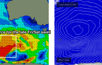
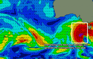
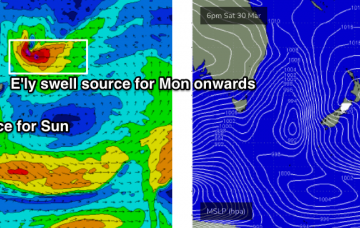
Small N/NE energy followed by a better run of S swell
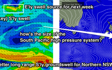
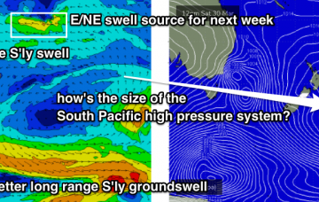
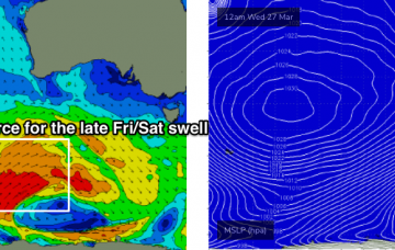
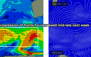
Weak and small N/NE swell over the coming days, fading as some new S'ly swell fills in, more reliable early next week.
The source of today’s E/SE swell in the north sits between a trough in the southern Coral Sea, and a Tasman high pressure system. More in the Forecaster Notes.
Today’s new south swell was the first in a series of southerly swell events (two of 'em!) that are expected to provide surf for the Southern NSW coast. More in the Forecaster Notes.
Stacks of surf ahead, but with initially dicey conditions for both coasts. More in the Forecaster Notes.
We've got plenty of surf on the way, as an extended series of winter fronts push through our swell window. More in the Forecaster Notes.
The storm track across the Southern Indian Ocean has been quite active over the last week, though most of the strength has been positioned at relatively low latitudes. More in the Forecaster Notes.
By and large, this weather progression has so far been aimed out of the South Arm’s swell window - up until this afternoon. The storm track’s been a little too north, so the resulting swell direction to date has been quite west, or even north-west across Tasmanian latitudes.
The Cape du Couedic wave buoy recorded some impressive wave heights today, up in the size range we see perhaps a couple of times per year (Hsig 7.5m, Hmax 13m). More in the Forecaster Notes.
There’s been no major change to the dynamics of the low generating this new swell - satellite data captured a healthy fetch of gale to storm force winds in our swell window on Sunday, and the latest model observations show the core winds are likely to peak later this afternoon, just W/SW of Tasmania (see below). More in the Forecaster Notes.
We've got a very good period of waves ahead beginning next week. More in the Forecaster Notes.