Upgrade in swell and very active period
Friday, 5 February 2021
Upgrade in swell and very active period
Friday, 5 February 2021
We've got a very active period of surf ahead along with an upgrade in the swell due tomorrow.
We've got a very active period of surf ahead along with an upgrade in the swell due tomorrow.
A mix of swells from differing directions and quality as winds continue to arrive from all sides of the compass.
Plenty more wind this forecast period and with one quality groundswell, followed by lesser quality, mid-period swells.
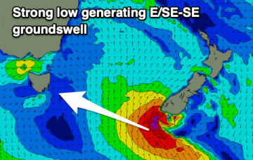
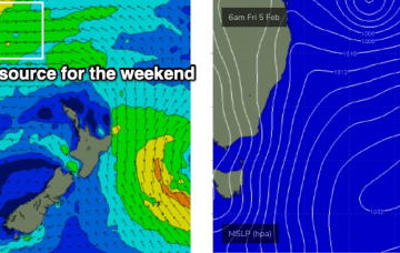
Ex-TC Lucas has been slow moving south of New Caledonia over the last few days, and is actually restrengthening today - though as an extra-tropical low.
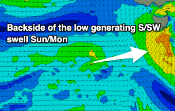
Make the most of the current surf before conditions deteriorate and the surf eases in size over the weekend. Conditions will slowly improve next week but a new swell will be on the way out by the time it cleans up.
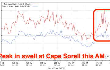
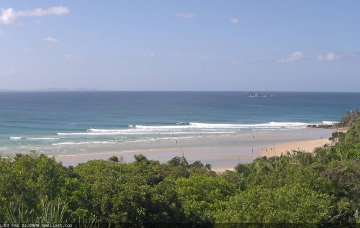
Today is the best day of the period for the beaches, so make the most of it and focus your attention to other breaks tomorrow.
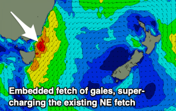
TC Lucas will remain slow moving south of New Caledonia for a few days. Current model guidance suggests a reintensification overnight Thursday into Friday morning (see below), aimed perfectly within our swell window.
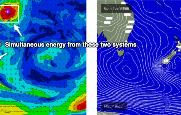
Our focus is firmly fixed to the Northern Tasman Sea, where an established trade flow over the last few days is being supercharged by two tropical cyclones: ex-TC Ana (now NE of New Zealand) and TC Lucas (tracking over New Caledonia).
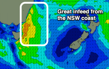
A strong, large and windy swell from the north-east is due over the coming days, cleaning up as it eases.
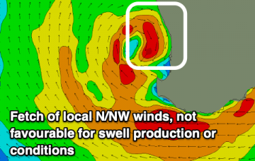
Nothing too amazing with lots of wind and not from the best directions with the coming swells.