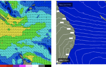
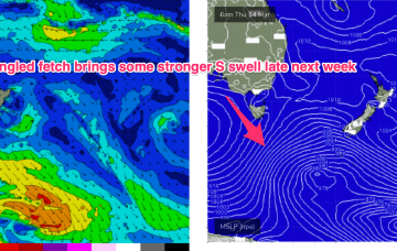
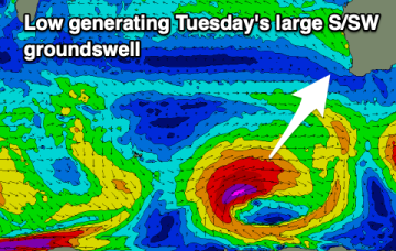
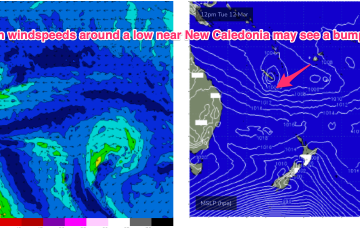
Easing surf on the weekend, with new energy next week but with dicey winds
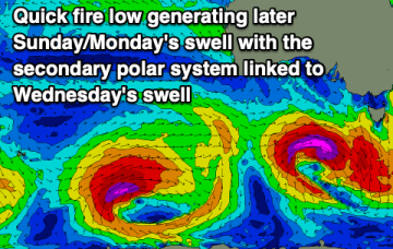
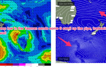
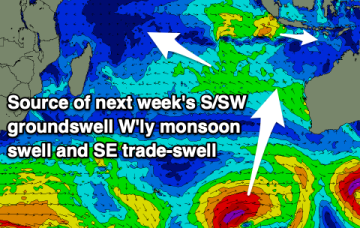
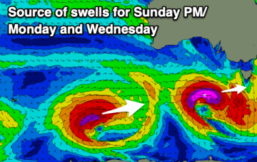
The coming outlook is trickier with funkier winds and mixed swells.
We’ve still got our late Summer pattern next week with high pressure straddling New Zealand, a monsoon trough strung across Northern Australia extending into the South Pacific and a long, broad tradewind fetch between the two broadscale atmospheric features.
Late in the week we’ll see a strong front with a more meridional fetch (N-S) move into the Tasman and if this comes off as modelled we’ll see a strong S swell pulse later Fri into Sat.
We've got favourable winds with varying pulses of swell this period, with one standout day.
There was a nice, lingering tail to the S swell event but we’re now entrenched in a classic late Summer pattern with strong high pressure moving into the Tasman, setting up a downstream blocking pattern and very healthy tradewind fetch through the Coral Sea, extending E into the South Pacific and south into the Northern Tasman.
The swell direction and winds will favour the South Coast mainly over the coming days with plenty of size to work with.
There was a nice, lingering tail to the S swell event but we’re now entrenched in a classic late Summer pattern with strong high pressure moving into the Tasman, setting up a downstream blocking pattern and very healthy tradewind fetch through the Coral Sea, extending E into the South Pacific and south into the Northern Tasman.
Fun sized swells with favourable winds for the beaches will provide endless opportunities for a paddle.
Complex forecast period ahead with a deepening monsoon trough with embedded lows.
The current S/SE swell will fade into tomorrow with new levels of W/SW swell on the build with slightly tricky winds.