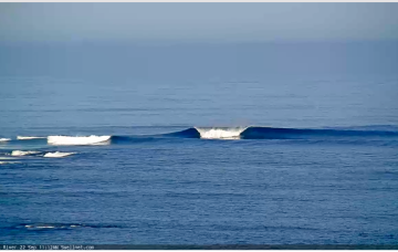
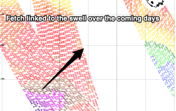
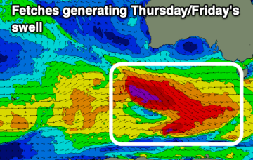
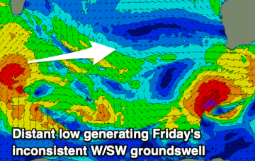
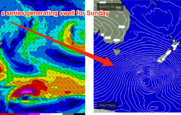
Plenty to work with over the coming days
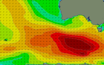
Lots of swell with periods of good winds, you'll just have to work the size pulses and swings in wind.
Below the continent, a very active Southern storm track is continuing to generate large seas with a few pulses of long period swell expected from this source.
A fun end to the week ahead of a trickier period owing to funky winds and mixed swell sources.
Varying winds this period from all degrees of the compass, but workable across both regions at times.
Plenty of swell to come this period but cleanest over the coming days. A larger swell is due on the weekend but with onshore breezes, cleaner and fun on the beaches early-mid next week.
A progression of strong Southern Ocean fronts will bring lots of swell but winds will be tricky at times.
A wintry pattern is on offer this week, with a stack of intense frontal activity impacting Tasmania and a deep, complex semi-stalled Polar low providing refracted S swell pulses through the week.
Following this rapid spike in wind and swell the week settles down quickly as strong high pressure moves in from the Bight across the south-east interior and becomes flabby, leading to settled conditions and small surf to end the working week
A slower week of surf with varying winds which will be favourable tomorrow and again late week.
A strong SW change is making it’s way up the coast as we speak but the coast-hugging low and subsequent over-sized S swell disappeared from model runs over the weekend. Models have swung back to the original EC resolution which sees a rapid-fire, coast-hugging fetch of strong to gale force SW to S winds through tomorrow..