Excellent surf ahoy!
Wednesday, 11 May 2022
Excellent surf ahoy!
Wednesday, 11 May 2022
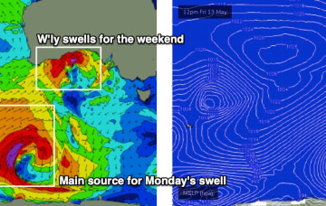
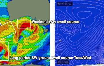
The models have slowed Friday’s frontal passage, which has delayed the weekends inbound westerly swell.
The models have slowed Friday’s frontal passage, which has delayed the weekends inbound westerly swell.
NE swell from the bottom end of the fetch is now looking a bit weaker and less persistent for East Coast Tasmania.
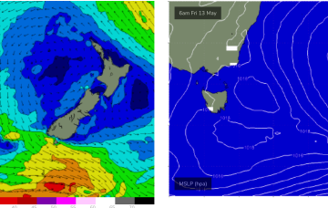
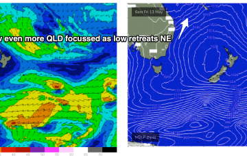
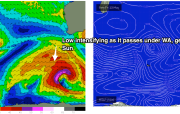
A trough forms a surface low later today off the NQLD coast, drifting south through Thurs and Friday before fading out and tracking back NE towards New Caledonia.
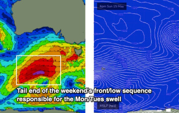
The outlook for early next week has improved a lot, thanks to a subtle shift in the timing of the main frontal passage.
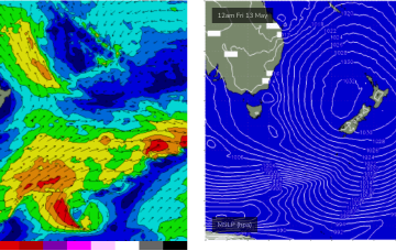
A long interior trough and developing trough/low off the North QLD coast are tightening the pressure gradient along most of the ridge, bringing fresh onshore winds and a deep E’ly pattern to the majority of Tasman Sea and Central/Southern Coral Sea.
No great changes to the front end of this weather/surf event, which is starting to kick into gear now. The latter stages have been wound back a few notches, reducing the expected wave heights over the peak of the swell, so let’s take a look at it.
We’ve got a blustery weekend ahead. It’s a classic winter frontal pattern, that may become supercharged thanks to a tropical infeed, courtesy of TC Karim.
As mentioned on Fri, a series of fronts pushing up from Heard Island bring quite an active week of mid-sized surf but finding windows of cleaner conditions will be a challenge.
A large high is now moving into the Tasman Sea and strengthening- that will be the main synoptic feature this week- setting up a deep ridge and a strong E’ly pattern through the Tasman Sea.
Further north an interior upper trough and potential coastal trough/surface low will combine to drive an intense E/NE to NE wind flow through the Coral and Northern Tasman Sea, generating a large swell for the CQ coast.