Very active period ahead
Monday, 20 September 2021
Very active period ahead
Monday, 20 September 2021
Tons of swell and generally workable winds for the coming period, best suited to more protected locations.
Tons of swell and generally workable winds for the coming period, best suited to more protected locations.
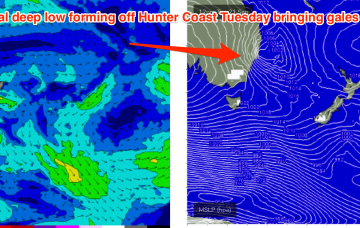
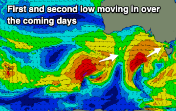
A better angled fetch associated with a frontal fetch moving NE into the Tasman later Mon into Tuesday sees surf build into the 3ft range at S exposed spots with early SW winds from the front turning WNW as it passes by.
We’re now on the tail end of the swell from the Tasman low, with a last little fun sting in the end of the tail expected this weekend and some tricky (largely unfavourable) wind shifts expected.
We’re now on the tail end of the swell from this week's Tasman low, with a fun, little sting in the end of the tail expected and some tricky, but largely favourable wind shifts expected this weekend.
Clean conditions with small, fun surf on the weekend. There's more swell and surf due through next week.
We've got more onshore winds tomorrow before conditions start to improve from Sunday. A fun S/SW groundswell is on the way ahead of flukier swells.
There's been a slight change to the initial low and swell incoming tomorrow, but Sunday is still looking good, with larger, windier surf into early next week. Conditions will improve later in the week.
The models have been struggling to resolved a low which is currently pushing in from the west, resulting in a slight adjustment of the weekend's outlook. Next week is overactive still.
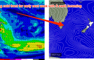
A large, twin centred high is now straddling Tasmania, bringing a regime of settled conditions, which will be brought to an end later this week as N’lies freshen along the Western flank of the high, generating useful NE windswell.
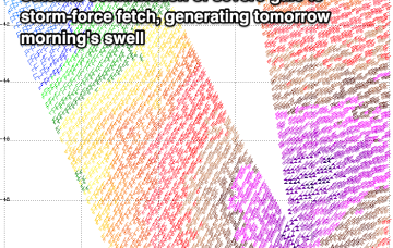
The broad supporting fetch is better aimed at the East Coast but not especially strong and the system is quite mobile, drifting away through today and briefly flaring up tomorrow as it moves over New Zealand overnight Thursday.