Great tomorrow, windy and stormy into the weekend

South Australian Surf Forecast by Craig Brokensha (issued Wednesday June 1st)
Best Days: South Coast tomorrow, protected spots South Coast Saturday and Sunday morning, stormy spots Mid Coast Sunday
Features of the Forecast (tl;dr)
- Easing S'ly swell tomorrow with N/NE tending fresher N/NW winds
- Small leftover surf Fri with strengthening N/NW winds
- New mid-period W/SW swell Sat, with a building windswell on the Mid Coast and strengthening W/NW-NW winds
- Strong W/NW tending W/SW winds with building stormy surf on the Mid Coast, choppy down South and moderate sized swells
- Larger mid-period SW swell Mon with strong SW winds, easing Tue with strong S/SW winds
Recap
Stormy, poor and cold surf across both coasts yesterday with 3ft+ waves on the Mid Coast and 4-5ft+ sets down South.
Today winds are still blowing strong onshore down South with a slight drop in size, cleaner and fun on the Mid with the swell dropping back to the 2ft range on the magnets.
This week and weekend (Jun 2 – 10)
 The broad, strong low linked to the recent rain and cold is now clearing to the east as another weaker, mid-latitude front pushes in from the west.
This will see winds swing back offshore from the N/NE, tending N/NW during the day, creating excellent conditions along with easing 3ft sets across Middleton.
Make the most of the swell before it fades, with Friday due to be 1-2ft and with tricky, strengthening N/NW winds. There'll be no size left across the Mid Coast tomorrow and with bumpy conditions.
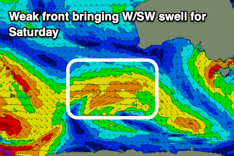
The weak mid-latitude frontal progression mentioned earlier should bring some inconsistent new W/SW swell for the weekend, with a better pulse for Sunday, generated by a better fetch of strong SW-W/SW winds projecting up and through the Bight tomorrow and Friday.
 Saturday's should come in at 3ft across Middleton with Sunday's a stronger 4ft, though the backside of the front will move in adding some additional windswell to the mix.
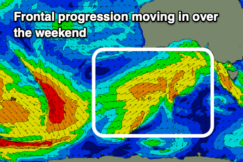
The Mid Coast will come in around 1-2ft Saturday (early ahead of a building windswell) while Sunday looks stronger and to 3-4ft but more so stormy, localised swell. Winds willl strengthen from the W/NW-NW on Saturday, favouring protected spots down South while whipping up 2-3ft waves on the Mid Coast through the day, with Sunday seeing strong W/NW tending W/SW winds.
We'll continue to see plenty of size into Monday as persistent fetches of strong SW winds are projected up and into us, mixed in with a stronger, but smaller SW groundswell signal.
 SW winds will accompany the swells though with 4-6ft surf due down South on Monday, 2-3ft on the Mid Coast.
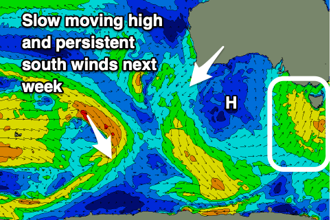
A strong high will take its time moving in from the west as the frontal activity persists up and across the south-east of the country and this will unfortunately see poor S/SW winds persisting down South until around Friday. By then most of the swell energy will be gone unfortunately. Following this the outlook is a bit quieter but more on this Friday.