Poor weekend better next week with swells from the west

South Australian Forecast by Craig Brokensha (issued Friday 22nd May)
Best Days: Monday South Coast, Wednesday South Coast, Thursday South Coast, later Wed and early Thu Mid Coast
Recap
Poor conditions with a large building swell through the afternoon on the South Coast, workable on the Mid Coast early but poor into the afternoon and 2ft or so.
Today conditions are better in protected spots down South with a large S/SW groundswell to 6ft or so, lumpy and to 1-2ft on the Mid Coast. Winds have since shifted more onshore though creating average conditions with cold rainy weather.
This weekend and next week (May 23 - 29)
Unfortunately the large S/SW groundswell that's breaking on the coast today will still offer size tomorrow morning but conditions are still set to be poor all weekend with a fresh and gusty S'ly wind. Easing sets from 4-6ft are due across Middleton, workable on the Mid Coast but back to 1ft or so.
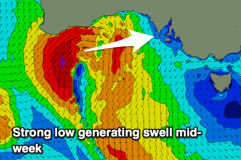
Our new long-period SW groundswell for Sunday is on track, generated by a strong low firing up east of Heard Island through Wednesday. A distant but good fetch of severe-gale to storm-force W/NW winds were generated, producing an inconsistent groundswell that should Middleton around 3ft+ through Sunday, remaining tiny on the Mid Coast.
 Fresh S/SE winds will create issues, while Monday looks great with a N/NE offshore, likely only tending NE into the afternoon as the SW groundswell eases from 3ft on the sets off Middleton.
The rest of the week then looks mixed with swells out of the west as a strong mid-latitude frontal progression sets up south-west of WA and pushes east under their state.
The first system will develop directly south-west of WA Monday and project a fetch of W/SW gales through our western swell window, weakening as it continues through the Bight and towards us.
The swell should build Wednesday and reach 2-3ft on the Mid Coast through the afternoon, while being a bit west for the South Coast and only building to 2-3ft off Middleton. Winds are a bit suss as the weakening front moves through bringing fresh NW tending W/NW breezes, easing later. N/NE tending N/NW winds should create OK conditions Thursday as the swell eases.
Some new less consistent SW groundswell is likely to take stop the easing trend into Thursday afternoon and provide more size on the South Coast, generated by a distant polar frontal progression, but we'll have a closer look at this Monday. Winds look favourable and from the N'th as well. Have a great weekend!
Comments
Tuesday no good down south? Winds look good...
Clean but in between swells and likely only 1-2ft off Middleton. There'll be options.
Hey Craig,
Do you think the mid will get to 1.5ft or so tomorrow with the 2.8 swell at 220 degrees, with a big incoming tide?
Need something to surf haha otherwise a day trip to yorkes might be in order
Nah I doubt it.