Lots of wind and swell inbound, with a few windows to aim for

South Australian Forecast by Craig Brokensha (issued Friday 29th November)
Best Days: Early Saturday protected spots South Coast, later morning Sunday protected spots South Coast, Wednesday and Thursday mornings South Coast
Recap
Fun waves across the South Coast yesterday morning with sets to 2ft off Middleton and a light variable wind, building into the afternoon but with fresh S'ly winds. The Mid Coast was tiny, but some reefs picked up glassy 1ft+ sets through the morning.
Today we've got tiny to flat conditions on the Mid and workable waves down South with a light onshore wind and 3ft of surf continuing across Middleton.
This weekend and next week (Nov 30 – Dec 6)
We've got a window of cleaner conditions due across the South Coast tomorrow morning, with an early W/NW breeze, shifting back to the W/SW and strengthening mid-late morning. Get in early for a small, easing 2ft wave off Middleton, better at Waits.
The Mid Coast will be tiny and onshore.
A low point in swell is expected Sunday morning, but an approaching cold front will bring a building S/SW swell through the day down South and building windswell on the Mid Coast.
Conditions will be favourable in protected spots down South with a strengthening W/NW breeze, shifting SW early afternoon, kicking up 2-3ft of windswell on the Mid Coast later in the day. The South Coast will likely be around 1-2ft in the morning, building later to 3ft.
 The strengthening onshore winds will be linked to the first of a series of strong polar fronts pushing up and into us, with moderate amounts of mid-period S/SW swell due from Monday through Thursday.
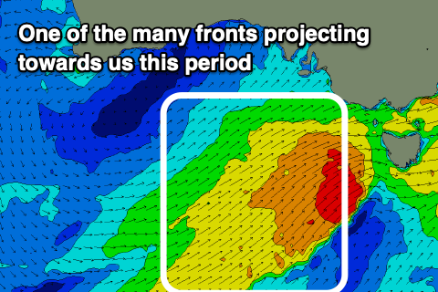
The strength of each front has been downgraded slightly but we'll see plenty of size, with the first front projecting up towards us over the weekend producing a good pulse of S/SW swell Monday to 4-5ft along the Middleton stretch, with 3ft waves on the Mid Coast.
A slight drop in size back to 4ft off Middleton is likely Tuesday morning, while the strongest of the fronts just passing under us Tuesday will produce a new spike in swell for the afternoon and Wednesday morning.
4-5ft waves should be seen again off Middleton later Tuesday and Wednesday morning, easing slowly from there as the frontal activity pushes east and weakens.
The Mid Coast looks to ease back slowly in size from 2-3ft on Tuesday and then 2ft Wednesday.
With the weaker frontal systems, winds are looking more favourable at stages, though Monday will be poor with strong W/SW tending SW winds, still fresh from the SW Tuesday. Wednesday is the pick with a morning W/NW breeze, shifting SW through the day and then lighter more variable SW winds on Thursday. More on this Monday though. Have a great weekend!