Good swell tomorrow, with another fun S/SW swell next Wednesday

Nias, Mentawai, South Sumatra forecast by Craig Brokensha (issued Thursday 15th October)
Best Days: Every day over the coming period
This week and next week (Oct 16 - 23)
This morning would have been very slow, but a new pulse of strong but inconsistent SW groundswell should now be showing across the region, with it due to reach an easy 6ft across exposed breaks, peaking tomorrow morning to 6-8ft+.
A drop is then due into the afternoon and further down into Saturday and Sunday, bottoming out Monday afternoon and Tuesday morning.
Our poor S/SE winds are due to continue through this swell episode and through most of next week before easing Saturday week or so. The reason for these bad winds is discussed in this article here.
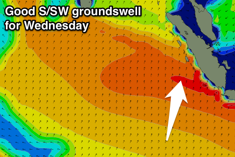 Into next week our good pulse of S/SW groundswell is still on track with a strong and favourably aligned low due to project a fetch of gale to severe-gale S/SW winds towards us.
This swell should build Tuesday afternoon to 4-5ft+ later in the day, peaking Wednesday morning to 5-6ft+ and then easing Thursday and Friday.
Longer term some fun S/SW pulses are due Saturday and Monday, but we'll have another look at this on Tuesday.
16 day Mentawai forecast graph
16 day Nias forecast graph
16 day South Sumatra forecast graph