Small, flukey south swells

Eastern Tasmania Surf Forecast by Craig Brokensha (issued Friday 23rd April)
Best Days: South swell magnets tomorrow morning, Sunday and Monday morning
Features of the Forecast (tl;dr)
- Easing S swell tomorrow with W/NW winds
- New, small S swell Sun with W/NW tending variable winds, easing Mon with a W/NW tending NE breeze
Recap
Nothing of note yesterday while some new S'ly groundswell should have been seen across the south magnets across the north end of the coast.
This week and weekend (Apr 24- 30)
Any S'ly groundswell seen today will ease back through tomorrow with fading 2ft sets on the regional south magnets up the northern end of the coast under a fresh W/NW offshore. There might be a late afternoon and weak SE change but the swell will be gone by then.
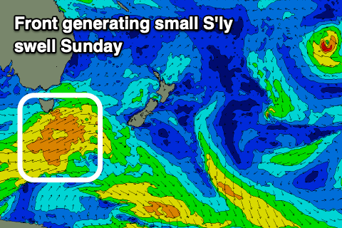 Into Sunday some new, mid-period S'ly swell is due to fill in, generated by a relatively weak though elongated polar front pushing up, past us tomorrow afternoon and evening.
The strength and pace of this system is a little worrying and as a result I've backed off the expected size with 2ft+ waves due Sunday on the south magnets, easing from 2ft on Monday.
A morning W/NW breeze looks to go variable Sunday favouring the south magnets, W/NW tending NE on Monday.
Longer term there's nothing major on the cards for the rest of the week but moving into the first week of May, we may see a tropical low squeezing a high in the Tasman Sea, then drifting south. This is a long way out but holds the best swell potential long term. More on this Monday. Have a great weekend!