Weak N/NE swell followed by S'ly swell regime

Eastern Tasmania Surf Forecast by Craig Brokensha (issued Monday 11th January)
Best Days: North swell magnets from late morning for the keen tomorrow, Sunday onwards
Features of the Forecast (tl;dr)
- Small N/NE windswell tomorrow with variable N-NW winds ahead of a strong, late morning S/SE change
- S'ly swell regime from Sun-Fri next week
Recap
Tiny 1-1.5ft waves Saturday, unsurfable Sunday and similar today.
This week and weekend (Jan 12 - 17)
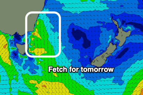 The only real notable swell for the coming week is due tomorrow, and that'll be a small, N/NE windswell. During this evening and early tomorrow morning, a strong fetch of N'ly winds will develop down the southern NSW coast, producing a small, weak 2ft wave tomorrow on the north-east swell magnets.
The early morning doesn't look great with the variable winds, but once the change hits there'll be some OK peelers in southern corners.
The swell looks to be all but gone Wednesday and there'll be no S'ly windswell really in the wake of the change beyond a 1-2ft onshore wave late tomorrow, with tiny surf due into the end of the week and start of the weekend.
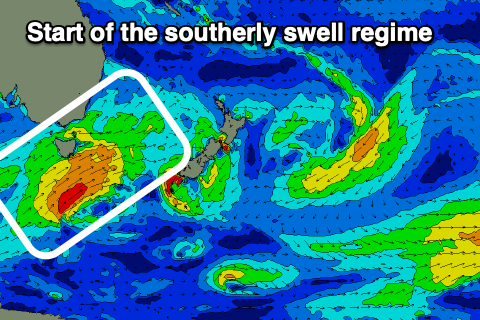 Looking at the outlook from Sunday though, we should see a strong node of the Long Wave Trough moving in from the west, bringing a flurry of strong polar frontal activity up past the south-east corner of the state and into the Tasman Sea.
With this we'll see good pulses of S'ly swell from Sunday through most of next week. Check back here on Wednesday and Friday for more details.