A couple of windows of opportunity ahead

Eastern Tasmania Surf Forecast by Ben Matson (issued Monday 21st October)
Best Days: Early Tues, Wed: small S'ly swells at south swell magnets. Fri: building N'ly windswells with an a'noon W'ly change. Sun/Mon: strong S'ly swells.
Recap: Small S’ly swells have padded out the last few days.
This week (Oct 14 - 17)
The publish time of these Forecaster Notes will be erratic this week, as Craig’s on annual leave. To receive an email when they go live, please edit your user settings here: www.swellnet.com/user
We’ve got small, flukey swells out of the Southern Ocean for the next few days. The storm track is well off-axis, but it’s nicely established so we’ll see overlapping swell trains producing small waves at exposed northern ends up to 2ft+. All other beaches will remain very small.
Getting the timing right is pretty hard because of the number of swells in the water at any one time. Conditions look a little flukey Tuesday and Thursday with pre-frontal N’ly winds both days (possibly light offshore early morning) but Wednesday looks clean under a W’ly breeze.
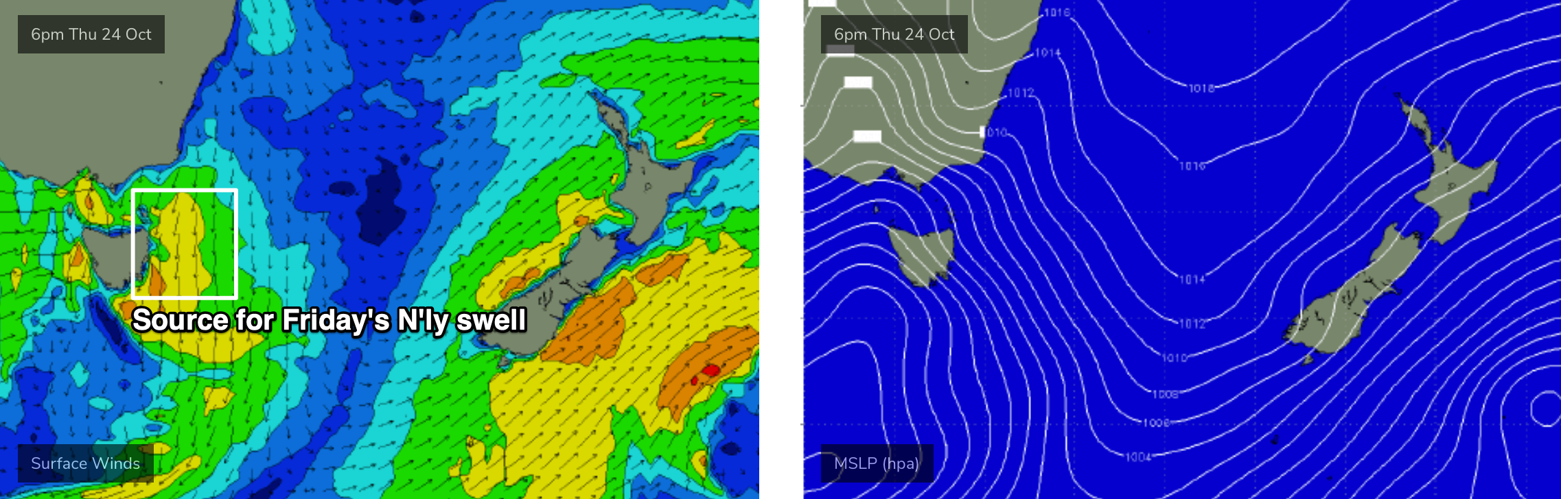
Friday looks like the best day of the week. Thursday's strengthening local N’ly flow (see below) will reach maximum strength early Friday morning, before swinging NW during the day and then W’ly later as a vigorous front crosses the region. Set waves should push up into the 3ft range at NE facing beaches so it’ll be worth booking in a late session.
This weekend (Oct 26 - 27)
Saturday looks small with residual swells across the region. Friday’s N’ly swell won’t last long and all other parts of our swell window will have been quiet in the days prior. Gusty offshore winds will however keep things nice and clean.
On the other hand, Sunday is shaping up nicely.
A broad trough of low pressure with several centres (the primary one very south in latitude, near the ice shelf) will push into our south swell window on Saturday, and we’ll see building S’ly swells into Sunday.
At this stage Monday is looking at have the most size, but early indications are building wave heights from 2-3ft to 4-5ft at south facing beaches throughout Sunday. Winds should be offshore so conditions are looking to be nice and clean. Let’s take a closer look on Wednesday to firm up the timing.
Next week (Oct 28 onwards)
The main feature on the long term charts is the Monday morning peak in size out of the south. It’s still some time away but we’re looking at anywhere between 4ft to maybe 6ft sets at reliable south swell magnets. Let’s keep a close eye on things over the coming days to see how things pan out as the models update.