Nothing surfable till next week

Eastern Tasmania Forecast by Craig Brokensha (issued Wednesday 29th July)
Best Days: Tuesday
Recap
Yesterday was fun across south swell magnets with an easing swell from 2-3ft, while today was smaller again and fading from 1-2ft.
This week and next week (Jul 28 – Aug 7)
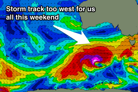 The models are showing an increase in swell tomorrow, but you'll notice it's from the NW, which is impossible and because our buoy point if offshore, it's incorrectly picking this up from the strong winds.
Instead the coast will become tiny to flat and remain so until early next week, when all the frontal activity that's being focussed into SA and Victoria finally moves more into the Tasman Sea.
On Monday evening a vigorous low is forecast to move over the state and project a fetch of S?SW gales up past us.
This should produce a short-lived pulse of S'ly swell for Tuesday morning to around 3ft across south facing beaches, easing steadily through the day.
Winds should be favourable and from the W tending W/NW.
It now looks like this will only be a single pulse, with the Long Wave Trough not moving into a more favourable position for our region until later next week, and this is when we're likely to see some larger S'ly gro. We'll look at this in more detail Friday.