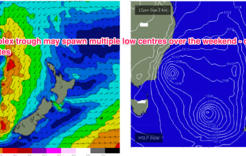
Small swells this week with more action on the weekend
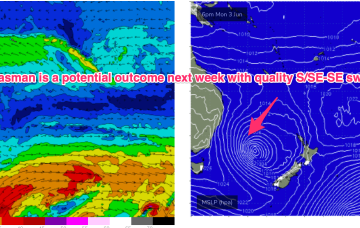
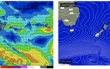
Fri looks a better bet as the fetch matures off the South Coast of NSW as a cold front arrives from the W.
A pair of weak cold fronts are expected to pass over Tasmania in the short term, generating small S swells which will overlap with the last pulses coming from the polar low now SE of New Zealand. A dynamic, troughy pattern looks set to unfold over the weekend.
An XL swell is on the build across the state with light winds in selected spots.
A pair of weak cold fronts are expected to pass over Tasmania in the short term, generating small S swells which will overlap with the last pulses coming from the polar low now SE of New Zealand. A dynamic, troughy pattern looks set to unfold over the weekend.
We've got building westerly energy and great winds for selected spots.
We've got some strong groundswell energy inbound but it's all very west in nature. With this comes some caveats.
The coming swells aren't as big as we've seen but look fun and clean.
The coming period is very active but there are windows of lighter winds to work around. Read on.
By Thurs we should start seeing slightly bigger E’ly tradeswell from a fetch developing next week in the Coral Sea.
A complex polar low is approaching the NZ corridor and although the frontal progression looks a notch less favourable for swell production up the East Coast we’ll still see S’ly groundswell pulses over the weekend.