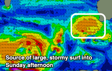
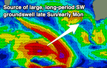
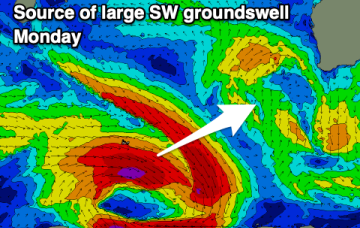
We've got improving winds and large swells for the South West due, slower on the weekend and most active next week.
Primary tabs
/reports/forecaster-notes/western-australia/2025/09/17/great-surf-developing-the-weekend
Craig
Wednesday, 17 September 2025
/reports/forecaster-notes/western-australia/2025/09/15/improving-surf-later-week
Craig
Monday, 15 September 2025
The South West will mostly be a write-off for the coming days, improving into the weekend and early next week.
/reports/forecaster-notes/western-australia/2025/09/12/poor-surf-the-coming-days-and-most-next-week
Craig
Friday, 12 September 2025
Large, developing stormy weekend again, with plenty more for next week. Improving conditions next weekend.
/reports/forecaster-notes/western-australia/2025/09/10/fun-tomorrow-ahead-return-winter
Craig
Wednesday, 10 September 2025
A fun mix of swells and clean conditions will create favourable surf tomorrow ahead of a return to oversized, stormy surf.
/reports/forecaster-notes/western-australia/2025/09/08/cleaner-easing-surf
Craig
Monday, 8 September 2025
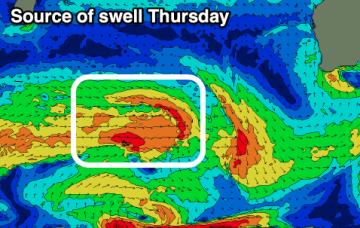
The coming days will offer cleaner conditions with easing surf, ahead of a fun new W/SW swell Thursday. From the weekend things will go onshore and build again.
/reports/forecaster-notes/western-australia/2025/09/05/poor-weekend-improving-next-week
Craig
Friday, 5 September 2025
The weekend will be a write-off, with large, improving surf through early next week.
/reports/forecaster-notes/western-australia/2025/09/03/quality-surf-tomorrow-and-early-next-week
Craig
Wednesday, 3 September 2025
Make the most of the current swell into tomorrow before a large, stormy weekend develops. Improving surf is due early next week.
/reports/forecaster-notes/western-australia/2025/09/01/decent-week-good-swells-and-light-morning
Craig
Monday, 1 September 2025
The coming mornings look good for a paddle, with the most size seen Wednesday/Thursday.
/reports/forecaster-notes/western-australia/2025/08/29/windows-offshore-wind-the-weekend-more-large
freeride76
Friday, 29 August 2025
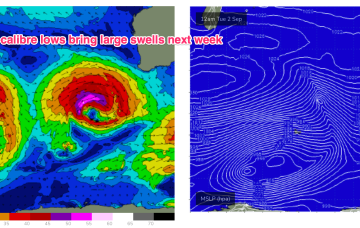
Plenty of energy through Tues and into Wed generated by rolling disturbances and a long zonal fetch in the screaming 50’s over the weekend .
/reports/forecaster-notes/western-australia/2025/08/27/brief-respite-offshore-winds-and-smaller
freeride76
Wednesday, 27 August 2025
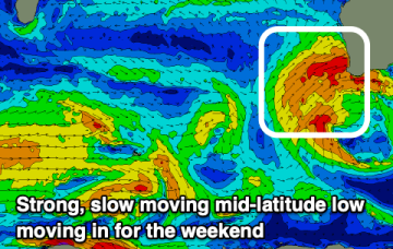
The system intensifies to storm forces status Sun/Mon as it tracks NE towards the SW corner, generating large swells for Wed.