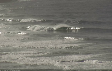
The current SE swell is easing across our coast now, and will be all but gone by Thursday.
Primary tabs
/reports/forecaster-notes/sydney-hunter-illawarra/2018/07/25/lengthy-period-small-surf-wth-brief
thermalben
Wednesday, 25 July 2018
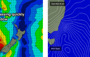
/reports/forecaster-notes/sydney-hunter-illawarra/2018/07/23/small-swells-south-and-south-east
thermalben
Monday, 23 July 2018
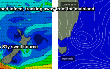
The low responsible for the weekend’s south swell stalled near New Zealand, and a broad southerly fetch on its western flank - whilst not aligned well for our coast - has generated a small new SE swell that’ll fill in over the coming days.

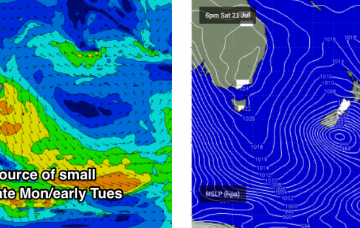
/reports/forecaster-notes/sydney-hunter-illawarra/2018/07/20/building-south-swell-saturday-pulsing
thermalben
Friday, 20 July 2018
We’ve got a bog standard south swell ahead for the weekend.
/reports/forecaster-notes/sydney-hunter-illawarra/2018/07/18/extended-period-mediocrity-interspersed
thermalben
Wednesday, 18 July 2018
Not much surf is expected for the rest of the week.
/reports/forecaster-notes/sydney-hunter-illawarra/2018/07/16/flukey-week-swells-ahead-strong-south
thermalben
Monday, 16 July 2018
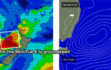
Last week, I discussed a flukey E’ly swell that was due to arrive very late today, and then peak overnight before easing through Tuesday, with the Far South Coast expected to see the most size.

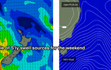
/reports/forecaster-notes/sydney-hunter-illawarra/2018/07/13/stacks-south-swell-then-couple-out-east
thermalben
Friday, 13 July 2018
We’ve still got a strong south swell ahead for Saturday.

/reports/forecaster-notes/sydney-hunter-illawarra/2018/07/11/easing-size-ahead-strong-southerly-swell
thermalben
Wednesday, 11 July 2018
The models have strengthened the southerly flow around this trough-cum-low later Friday, though it’ll provide a short-lived peak in size that may occur overnight under the cover of darkness.
/reports/forecaster-notes/sydney-hunter-illawarra/2018/07/09/strong-easing-swells-tuesday-windy-south
thermalben
Monday, 9 July 2018
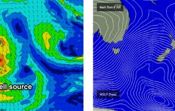
The strong, broad post-frontal fetch responsible for today’s impressive south swell is now exiting our swell window.
/reports/forecaster-notes/sydney-hunter-illawarra/2018/07/06/strong-south-swell-sunday-onwards
thermalben
Friday, 6 July 2018
Sunday however is still on track for a strong south swell to build through the day as a strong series of fronts push through the lower Tasman Sea.
/reports/forecaster-notes/sydney-hunter-illawarra/2018/07/04/plenty-fun-ene-swell-ahead-extended-run
thermalben
Wednesday, 4 July 2018
Confidence in the outlook for Thursday has plummeted. Main reason being: Monday’s read on the synoptics had anticipated a broad, slow upwards trend trough today, plateauing into Thursday mooring, then easing from Friday.