Large, wet and stormy swell to kick off winter

As one of the most underwhelming autumns comes to a close on the East Coast (well for southern NSW at least) early winter is set to see large storm surf develop from the north-east.
This May is set to break records again with average day time temperatures in Sydney sitting 3.7deg above average, and with only 7.2mm of rain - an incredible 112mm short of the long term average.
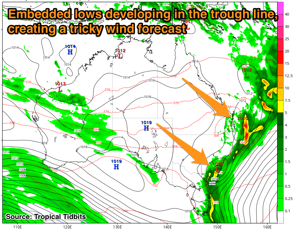
This is all set to change this weekend though as a deepening inland surface trough over central Western Australia is forecast to drift east and combine with another trough developing off the Eastern seaboard.

A strong and stationary ridge in the Tasman Sea will feed moisture to the dyanmic weather pattern developing down the East Coast, resulting in torrential rain but also large building storm-surf.
The interaction between the trough and ridge will see a strengthening fetch of E/NE gales directed into the South East Queensland, NSW, and the Tassie East Coast, with small embedded lows seeing stronger core winds upwards of 40kts.
From Saturday the swell will build steadily as the trough deepens, becoming large and dangerous into Sunday and Monday. Unfortunately the proximity of the system and size of the waves will destroy any banks that have developed over the last couple of months up and down the coast. It's a bank buster all right.
With the small embedded lows, an offshore wind change is currently hard to pick but at this stage SE Qld and Northern NSW will see winds improve first maybe sometime through Sunday, while across Southern NSW and Tassie it'll be early next week.
As soon the as the winds go offshore the swell will begin to drop, so picking the window with big surf and good winds will be the key to maximising this system. As will finding a location capable of handling the size.
These systems are complex and dynamic, so we expect that the forecast might shift around right up until the event itself this weekend. Therefore keep an eye on the forecasts and comments below for running updates.
Comments
shit. oh well it had to happen sooner or later.
Might destroy some of the good banks around but create some good ones also. The southern end of beaches on the cc might benefit from this. Pulling the summer excess sand out a bit to create a few new banks
Frothing!!
Hopefully, the large NE swell hits Queenscliff bombie and the dispersed waves create some banks @ Manly. At the moment, the banks are pretty straight when then swells bigger than 3ft.
couple of banks on Sydney's northern half need some changes, hopefully this NE energy can mix it up and also minimize these f@#$%& crowds!
Offshore change looks to develop across most locations through Sunday morning now and with a large building E/NE groundswell. Excellent for at least 3 days through the following week as well.