All things SAM

Victoria Forecast by Craig Brokensha (issued Monday 6th August)
Best Days: Surf Coast Thursday, exposed beaches into the afternoon, keen surfers Friday with strong winds, Surf Coast Sunday and Monday mornings
Recap
Tricky and small westerly swell energy provided frustrating surf most of the weekend, inconsistent on the Surf Coast with the exposed beaches fairing best, while to the east winds held just north enough to create OK conditions.
A stronger long-period W/SW groundswell due into the afternoon only kicked late in the day to 3ft+ on the Surf Coast magnets, but N'ly winds continued to favour the beaches with large sets on the Mornington Peninsula beaches. This was a little under expectations, with the west direction overriding the strength and slow moving nature of what was looking like a great system.
This morning the swell is just hanging at a similar size to late yesterday, but with better winds for the Surf Coast reefs. We'll see the swell easing through the day as winds persisting from the north-west.
Today’s Forecaster Notes are brought to you by Rip Curl
This week and weekend (Aug 7 - 12)
Want to receive an email when these Forecaster Notes are updated? Then log in here and update your preferences.
The coming week ahead will see a continuation of tricky and less than ideal westerly swell energy that's being generally over-forecast by our models.
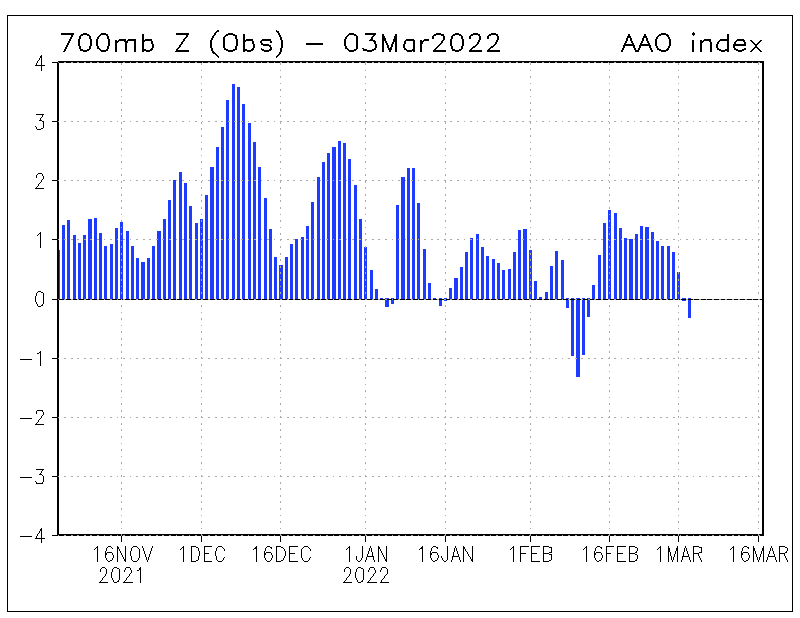
The reason for all this high-riding (latitudinally) frontal activity is a strong negative Southern Annular Mode signal. The (SAM) is an index representing the shift in the polar westerlies (westerly storm track) either south towards the pole away from us, or north towards the equator.
When the SAM is negative as we're currently seeing (below - August to the right), the westerly storm track is shifted further north, hence bringing all this mid-latitude frontal activity.
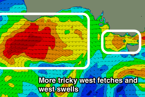
Through this week we'll see back to back pre-frontal and post-frontal W/NW-W/SW fetches pushing in from under WA and across us through this week.
Firstly tomorrow we're looking at an easing acute W'ly swell and small mid-period W/SW swell for the afternoon from a weak front pushing in this evening.
 The Surf Coast looks slow and mostly to 2ft, with possibly the odd 3ft'er across magnets, with surf in the 4ft range to the east, kicking more to 5ft into the afternoon.
Winds will be gusty out of the W/NW favouring the Surf Coast all day while creating poor conditions to the east.
A temporary low point is likely early Wednesday with sets to 2ft at magnets on the Surf Coast and to 4ft on the Mornington Peninsula beaches, but the strongest front this week will push through during the day, bringing a building and strengthening mid-period tending groundswell through the afternoon but more so Thursday.
This front will project a fetch of W'ly gales from under WA, east through the Bight and then across us Wednesday.
As the front pushes through we should see the swell building 3ft late in the day at magnets on the Surf Coast and 6ft on the Mornington Peninsula under gusty W/NW winds, shifting W/SW with the passing front.
At this stage Thursday morning looks the best of the coming week as winds quickly shift back to the NW and then N/NW with another approaching front along with a peak in W/SW swell to 3ft+ on the Surf Coast and 6ft+ on the Mornington Peninsula.
We'll see the swell easing through the day, smaller through Friday as winds become strong and tricky. They'll be out of the N'th through the day but up to 30kt creating most likely average conditions across most spots, easing a touch while tending more N/NW through the afternoon.
Moving into the weekend some small background W/SW groundswell is due Saturday from a less than favourably aligned pre-frontal fetch of W/NW gales moving in from the south-east Indian Ocean. The Surf Coast will be slow and around 2ft with a W/NW breeze, bigger but bumpy to the east.
We're likely to see some better swell energy building through Sunday and into early next week out of both the W/SW and SW from a broad slow moving polar low, but check back here Wednesday for more on this.
Comments
My plums will disappear soon with these westerly swells. The long lulls between sets are killers.
Not much happening in Torquay this morning, but 13th is seeing some good sets!