Poor tomorrow, improving from the middle of the week
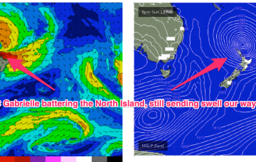
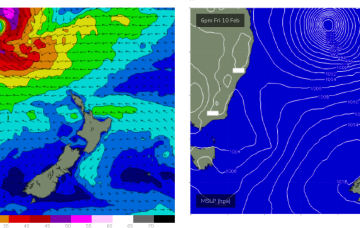
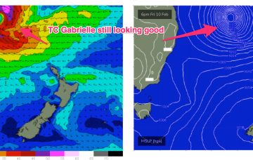
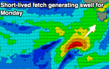
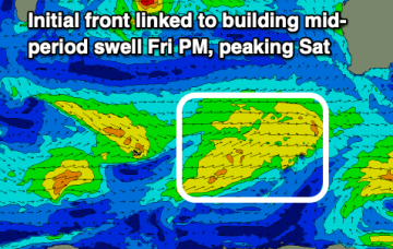
A strong SW groundswell will be spoilt by onshore winds tomorrow, improving slowly from Wednesday.
Ex TC Gabrielle is still the main game as far as swell production goes. The former cyclone is now a large sub-tropical storm (SS) slow moving near the top of the North Island. Current ASCAT (satellite windspeed) passes show a broad but short fetch of gales to severe gales extending off the west coast of the North Island, slightly off axis for the East Coast but maintaining a strong swell regime in the short term.
Improving conditions with fun sized swells for the coming week, a tease mostly on the Mid Coast.
Inconsistent but fun sized W/SW swells with favourable winds for the beaches come Wednesday through Friday.
Now that the low axis of TC Gabrielle has moved south of the CQ coast we’ll see diminishing swells.
Severe tropical cyclone (Cat3) Gabrielle is currently tracking SE at about 21 knots and is located about 413 nm NE of Brisbane. This severe storm is expected to undergo an extra-tropical transition through Friday evening, resulting in an expansion of gale to severe-gales around its southern flank as it continues drifting south-east towards New Zealand.
We've had a good run but we look to be entering a slower period ahead of more action from next weekend.
Severe tropical cyclone (Cat3) Gabrielle is currently tracking SE at about 21 knots and is located about 413 nm NE of Brisbane. Early incarnations of the TC as it was drifting SW showed a fetch of storm force to severe gale NE winds around the NE quadrant which is producing a rare NNE-NE long period swell
Decent winds for the weekend with a fun sized swell for the South West. Larger surf is due next week but with dicey winds.