Relentless run of onshore winds
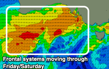
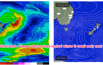
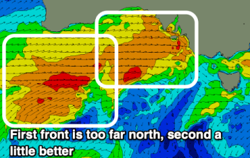
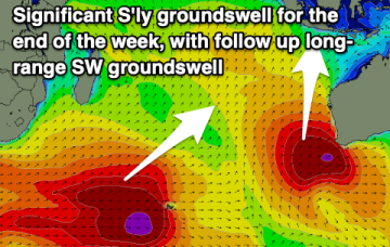
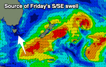
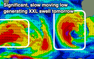
Unfortunately the outlook for the South West of the state is poor with persistent fronts, large swell pulses but no offshore windows.
Residual S/SE groundswell pulses from the off axis fetch as it drifted slowly SE of the South Island will put a floor under wave heights before we see a fresh round of S swell early next week. Good news for some areas south of the border, with a much less exciting but seasonally expected outlook for SEQLD.
The South Coast will be the pick of the period with the cleanest conditions in this windy, frontal period.
A more typical winter pattern which we saw in June is set to return, with high pressure over the continent ridging against frontal activity with a W’ly flow extending right up to the sub-tropics. Residual S/SE groundswell pulses from the off axis fetch as it drifted slowly SE of the South Island will put a floor under wave heights before we see a fresh round of S swell early next week.
We've got an inconsistent, westerly swell due tomorrow followed by a downgrade in the weekend's swell.
Upgrade! Indonesia will see a significant, long-period S'ly groundswell to end off the week.
Inconsistent but fun pulses of S/SE swell with favourable winds.
We've got a good week of waves with light winds and pulses of south-southeast swell.
Poor conditions along with an XXL swell is due tomorrow, easing through Wednesday and Thursday. Windows for a clean wave will be limited.
Before we get to that point, we still need the developing S/SE swell to push through, reach a plateau and then slowly abate - which will happen overnight and then gradually through Tuesday.