Tons of swell inbound
Wednesday, 23 August 2023
Tons of swell inbound
Wednesday, 23 August 2023
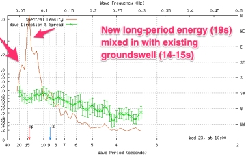
The swell has come up strongly this afternoon and there's plenty more to come.
The swell has come up strongly this afternoon and there's plenty more to come.
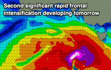
A cold front and long trough are bringing a S’ly change to the NSW coast, extending into the sub-tropics later today and overnight. There’s not a great deal of useful swell generating winds associated with the change so only modest short range S swells are expected to accompany it. The lingering troughy pattern gets much more dynamic over the weekend (and next week) as a powerful high approaches from the Bight.
Tomorrow remains dicey for the South West, with clean but small waves into Friday/Saturday. A fun new swell is due Monday but that's it for the week.
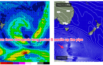
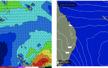
The Cape du Couedic buoy has picked up the new long-period swell with large surf due to develop through the mid-late afternoon.
A cold front and long trough are bringing a S’ly change to the NSW coast, extending into the sub-tropics later today and overnight. There’s not a great deal of useful swell generating winds associated with the change so only modest short range S swells are expected to accompany it.
Make the most of the current conditions and coming swell before things take a turn for the worse Friday afternoon through the weekend.
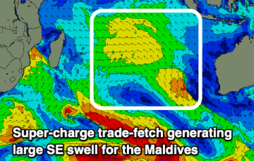
Make the most of the coming swell as the outlook goes a little quiet for Indonesia as the Maldives fire.
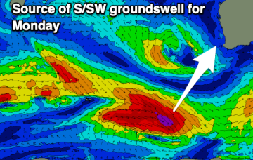
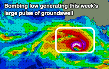
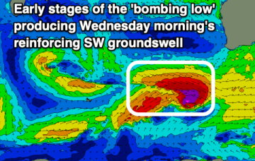
We've got a low currently 'bombing' to our west, bringing strong levels of acute W'ly groundswell this week.
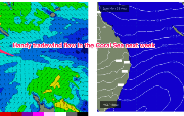
We’re now seeing a high pressure surge with building tradewinds across the Coral Sea. The fetch is a little disjointed, which does tap a bit off the size but we’ll still see some rideable 1-2ft surf develop through Tues/Wed.
Winds will remain onshore with the current swell, around Margs only weakening from Thursday as the surf becomes smaller.