Back to back weeks of large, stormy surf

Western Australia Surf Forecast by Craig Brokensha (issued Monday July 5th)
Best Days: Keen surfers Friday, beaches Saturday morning, keen surfers Tuesday and Wednesday mornings
Features of the Forecast (tl;dr)
- Large, onshore surf easing a touch tomorrow, kicking again Wed, easing Thu as winds relax a touch
- Outside chance of S/SE winds Thu AM in Perth and Mandurah (check back Wed)
- Increasing onshore winds and building swell Fri, peaking Sat with a new groundswell
- Easing SW swell Sun with strengthening N/NE winds
- Large, stormy and onshore next week
Recap
Smaller surf but clean conditions early across the South West with 3ft sets for the keen, 1-1.5ft across Mandurah and Perth.
Yesterday was poor with freshening onshore winds and some local, building swell.
Today the surf is large and stormy from the first of a series of fronts pushing into us, with nowhere to recommend for a paddle.
This week and next (Jul 6 - 16)
Onshore, that's the theme of the coming period, with strong fronts and stormy seas due for the most part through this week and next.
Currently the satellite setup shows exactly what's bringing the current spell of bad weather and stormy surf.
A broad, stalling mid-latitude low is spawning embedded lows and fronts which are rotating clockwise around it, and into us.
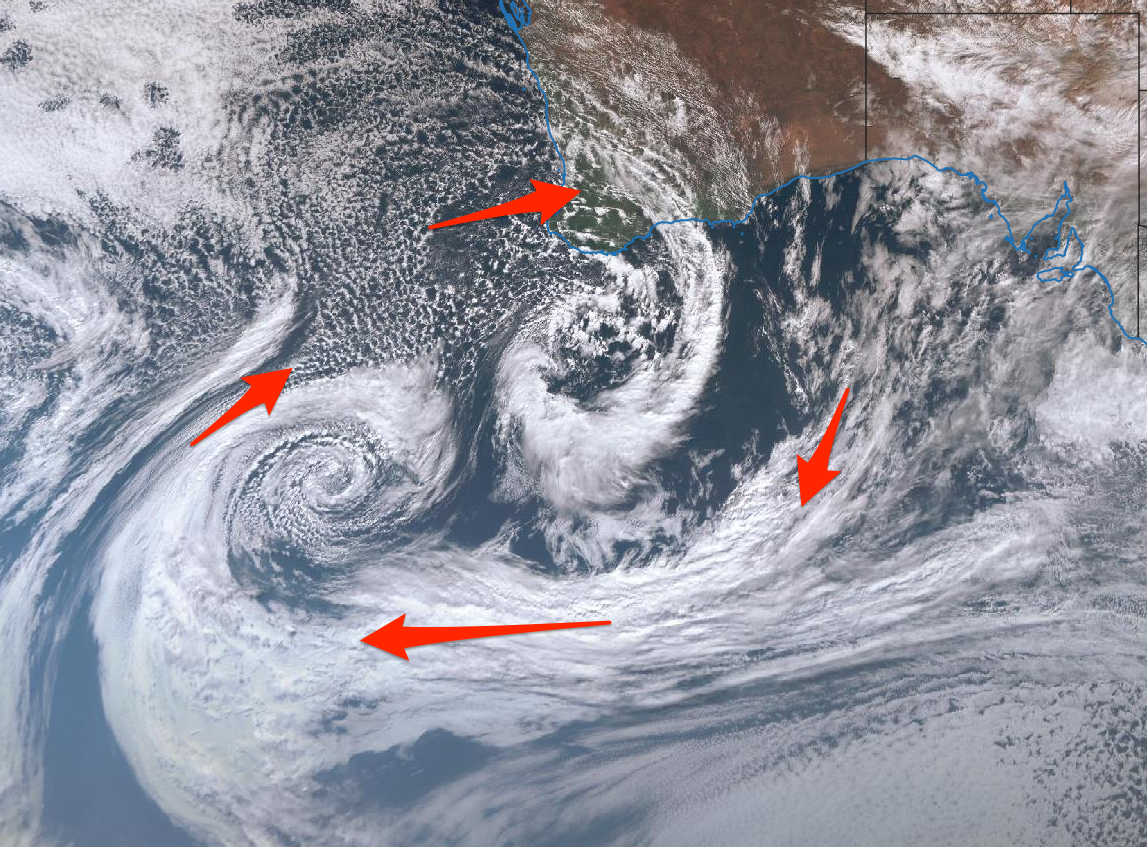
This will occur through this week, with the first system moving in through today, bringing today's large stormy swell, but we'll see it pass overnight, with weakening winds into tomorrow, strengthening ahead of the next front.
We should see the swell ease back to 8-10ft in the South West, 4ft across Mandurah and 3ft+ across Perth with strengthening NW winds.
We'll see the front move in Wednesday, kicking the size a little again but with strong SW winds, tending more W/SW through the day.
Unfortunately there's no real let up in the onshore winds on Thursday, though they'll ease back in strength, moderate to fresh in the South West and possibly S/SE at dawn further north, though there'll be lots of wobble and lump. Check back here Wednesday for confirmation on this.
Size wise the swell looks to be back to 2-3ft across Mandurah and 2ft+ in Perth.
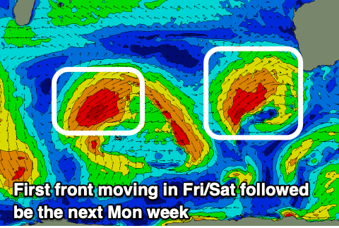 As we move into Friday we'll see the next strong frontal system moving in, bringing strengthening NW tending W/SW winds.
This looks to bring an increase in windswell Friday ahead of the groundswell Saturday, peaking through the afternoon to 8ft to possibly 10ft in the South West, 3ft+ in Mandurah and 3ft across Perth.
Winds look to remain onshore from the W/SW, fresh though easing into the afternoon with Sunday possibly seeing N/NE winds ahead of the next front. This will be with easing surf from Saturday afternoon.
This window of cross-shore winds will be slim, with another strong mid-latitude low and onshore winds due to move in Monday, bringing large, stormy onshore surf again. It'll be a progression of fronts, persisting all of next week, likely relenting into the end of the week. More on this Wednesday.