Poor weekend and most of next week

Western Australia Surf Forecast by Craig Brokensha (issued Friday June 18th)
Best Days: Desperate surfers selected spots Perth and Mandurah tomorrow AM and Sun AM
Features of the Forecast (tl;dr)
- New SW swell building Sat with strong N/NW tending W winds (fresh to strong N/NE tending N-N/NW to the north), followed by a larger W/SW swell Sun with strong S winds (variable further north, tending SW and then strengthening from the S/SW)
- Poor, junky S'ly swell early next week with strong S/SW winds, only abating Thu
Recap
Our large, powerful, long-period SW groundswell came in bang on forecast with excellent, pumping 12-15ft surf across the South West, 4ft in Mandurah and 3ft across Perth as winds remained favourable all day.
Today the swell was still great but on the ease and with freshening winds from the northern quadrant. The South West dropped from 6-8ft, 2-3ft in Mandurah and 2ft across Perth.
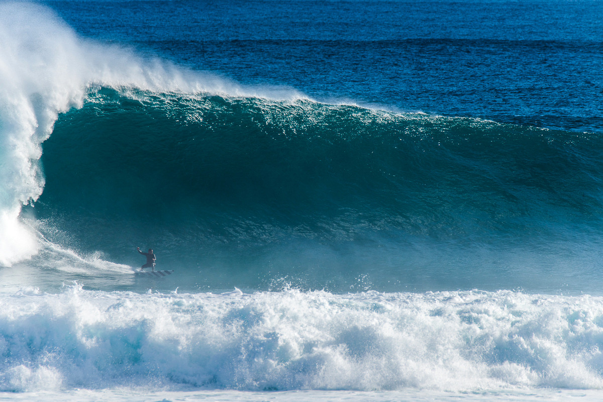
Exhibit A, Margs pumping yesterday. Stefan Marsella charging, shot by Peter Jovic
This weekend and next week (Jun 19 - 25)
After the last two days of great surf, the weekend and early next week look like absolute shockers.
A mid-latitude front is pushing in from the west-southwest and we'll see it bring a strong N/NW tending NW breeze to the South West, N/NE early in Perth and Mandurah but back to 1-2ft max.
 A new mid-period SW swell is due to arrive into the afternoon, followed by a better pulse Sunday (peaking through the middle of the day afternoon) generated by the mid-latitude front that's currently edging in.
The swell on Saturday should build to 4-6ft across the South West, 2ft to the north but with those poor winds, with Sunday's reaching 6-8ft through the day. 2-3ft in Mandurah and 2ft+ across Perth.
A developing low in a trough low will bring funky winds Sunday, swinging from SW pre-dawn to strong S/SE-S around dawn and persisting into the afternoon across the South West. Perth and Mandurah should see variable winds in the morning, then shifting SW late morning, stronger S/SW into the afternoon.
The structure of this low which now looks to form immediately adjacent to the coast now looks poor for swell generation with it being quite meridional in alignment. This means we'll see a fairly south to north fetch of severe-gale S/SE winds developing off our coast, generating a large S'ly swell for Margs and locations further north. Size wise the swell will be very acute but to 8ft+ or so at selected spots, 2-3ft Perth and Mandurah.
Winds will also be poor and strong from the S/SW, persisting Tuesday owing to the slow moving nature of the mid-latitude low. We may see winds start to slowly ease on Wednesday but remain from the S/SW, possibly tending variable NE for Thursday morning.
This low will disrupt our normal swell window resulting in no swells of significance forming while it sits there all week.
Some inconsistent, background swell is due later in the week, but we'll have a closer look at this on Monday.
Longer term it looks like a strong node of the Long Wave Trough will fire up to our west, bringing strong frontal systems into the end of the month and plenty of wind, but more on this in the next update. Have a great weekend!