Plenty of swell, but mostly onshore winds

Western Australia Surf Forecast by Craig Brokensha (issued Monday 15th July)
Best Days: All regions tomorrow and Thursday
Recap
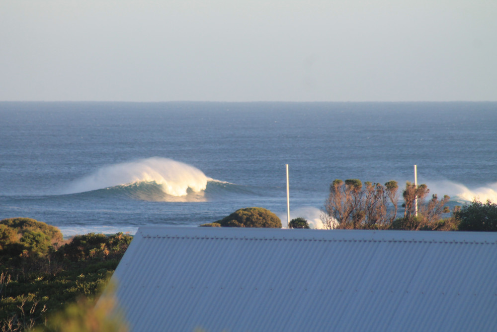
A great weekend of waves across the South West with pumping 5-6ft waves Saturday, back to a smaller but fun 3-5ft yesterday morning ahead of a new swell into the afternoon.
Mandurah was a good 2-3ft Saturday morning, tiny Sunday ahead of the new swell, 1-2ft in Perth Saturday morning.
Today the swell increase from yesterday is still there but on the ease with clean 6ft+ waves across the South West, 2ft+ to the north. Make the most of it as winds will swing more N/NE during the day.
Today’s Forecaster Notes are brought to you by Rip Curl
This week and weekend (Jul 16 – 21)
These notes will be short as Ben's on annual leave.
We've got lots of swell on the cards for the forecast period but onshore winds look to plague most regions as the frontal activity pushes too close, up and across us.
Early tomorrow morning will likely be the best time to surf across the South West through this period with an early variable E/NE-NE breeze along with a new building W/SW groundswell.
This swell, the second after Sunday's should build to a slightly bigger with 6-8ft+ sets across the South West, 3ft+ in Mandurah on the sets and 2-3ft in Perth through the afternoon with weak NW sea breezes, even possibly variable.
 Make the most of this as come Wednesday an approaching front will bring freshening N/NW winds, strong from the W/NW into the afternoon as Tuesday's W/SW groundswell eases. Perth and Mandurah are likely to see early N/NE winds with some fun sized but bumpy sets early.
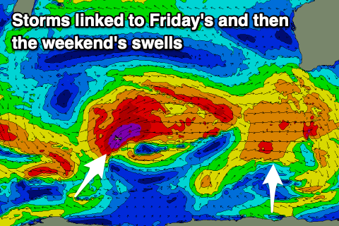
A strong and broad node of the Long Wave Trough will move across us later week, bringing back to back fronts and large windy swells from Thursday, though this day is being over-forecast as the models incorrectly combine a distant long-period W/SW groundswell with a mid-period closer-range SW swell.
Size wise Margs looks to come in around 6ft to maybe 8ft and a window of light winds (morning offshore) are expected as we fall in between fronts. Mandurah looks 2ft to maybe 3ft, with smaller waves building to 2ft in Perth.
The swell is due to drop temporarily Friday with poor NW tending W/NW winds across all locations, S/SW tending SW on Saturday as a new large long-period W/SW groundswell starts to build.
This will be generated by a strong fetch of severe-gale to storm-force W/SW winds being projected up through our western swell window from the Heard Island region.
Margs should build to 10ft+ later Saturday, easing from 10-12ft on Sunday morning with 3-4ft waves in Mandurah and 3ft in Perth on the sets though with W/SW winds from the front generating the swell.
Behind this we may see a more significant polar front generating a larger SW groundswell for early next week. This again looks to be with onshore winds improving from Tuesday as the size eases, but more on this Wednesday.