Small weekend, larger later next week but with southerlies

Western Australia Surf Forecast by Craig Brokensha (issued Friday 5th December)
Best Days: Margs tomorrow morning, Margs and Perth Tuesday morning, Margs Wednesday morning
Recap
Yesterday was poor across all locations, while today a lift in fun SW groundswell across the South West with offshore winds has created a good morning of surf with sets to 4-5ft.
Further north the swell was still tiny but clean with longer boards the pick for a morning paddle.
This weekend (Dec 6 - 7)
Tomorrow will be clean again in the South West and Perth with winds from the E/SE through the morning, but to the north around Gero, less favourable S/SE winds are expected.
The swell will be on the ease from today though with Margs the best option with easing 3-4ft sets.
A small lift in new SW groundswell is due through Sunday but not above the 3-5ft range across the South West and with average S/SE winds. Therefore surf tomorrow if you're looking for a wave over the weekend.
 Monday onwards (Dec 8 onwards)
Into the start of next week winds will persist with strength from the S/SE across most of the state as a deepening inlnd trough squeezes against a strong blocking high to our west.
A small to moderate and inconsistent SW groundswell is due into Monday, peaking Tuesday morning to 4-5ft in the South West, 1-1.5ft in Perth and 2-3ft up at Gero.
This will be the best day to surf as winds swing a touch more east and to the SE across Margs and Perth.
Wednesday will be better again with E/SE offshores but a small easing swell.
As touched on last update, the outlook into the end of the week and weekend is more active, but.. winds aren't looking to co-operate at this early stage.
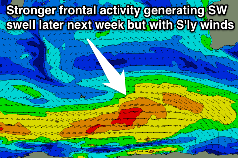
The inland trough is expected to move closer to the coast and merge with another trough approaching from the south-west on Thursday next week, bringing S'ly winds when the new swell is due to fill in.
The swell we're expecting will be produced by a series of strong but not overly impressive polar fronts fire up to our south-west, aiming fetches of W/SW gales through our south-west swell window.
An initial pulse Thursday should be followed by the strongest increase Friday, peaking at 5-6ft in the South West, 1ft to possibly 2ft around Perth and 3ft up at Gero. Winds as touched on above will be poor and from the S'th to S/SW.
We'll confirm this again on Monday though. In the meantime, have a great weekend!