Poor weekend of waves, then a fun week of smaller surf ahead of another sizey pulse

Victorian Forecast by Ben Matson (issued Friday May 16th)
Features of the Forecast (tl;dr)
- Large swell Sat but poor winds, easing Sun but still tricky winds
- Smaller Mon/Tues/Wed with better conditions
- Chance for a solid long period swell building later Thurs, peaking Fri, but winds look dicey
Recap
Cape Sorell showed the expected rebound in swell energy overnight Wednesday, and so Thursday provided fun clean waves around 3ft west of Melbourne with ruffled options east of Melbourne in the 4-5ft range under a light/mod W/NW flow. This morning dawned a similar size across the coast, though Cape Sorell slowly built in size and period through the morning, ahead of a more pronounced increase in energy early-mid afternoon. This has translated to a similar swell trend across the coast, building from 3ft this morning to 3-4ft early afternoon though we’re now starting to see inconsistent 4-6ft sets across the Surf Coast reefs. Winds have remained generally light from the NW thru’ W for much of the last two days however we’ve just seen moderate SW breezes crop up in the last hour or so.
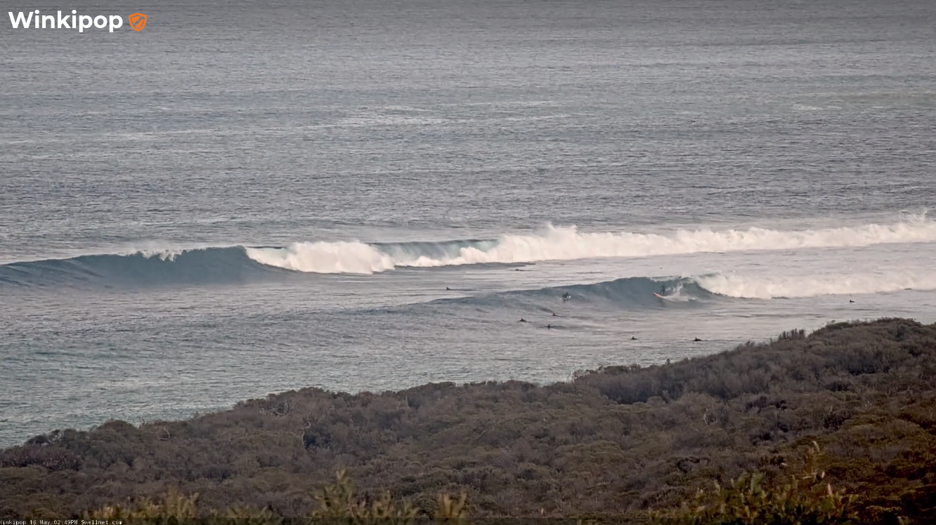
Nice sized sets mid-afternoon today
This weekend (May 17 - 18)
Unfortunately, the timing of the southerly change expected early Saturday is not favourable for Victorian surfers.
The latest high res models have tightened up the arrival time, which looks like it’ll be across King Island around midnight and probably into the Vicco coast in the hour or two before dawn. Whilst we can never completely rule out a brief window of favourable winds, tomorrow morning is looking very unlikely.
As such only protected corners will have worthwhile waves. Note: the southerly flow isn’t favourable for anywhere near as many locations as a westerly (or even sou’wester) so keep your expectations in check.
As for side, there won’t be any shortage of it with the current swell expected to show 5-6ft+ across the Surf Coast swell magnets, easing by a foot or two during the day. East of Melbourne’s open beaches will be considerably bigger but again, with limited options.
Easing but still-annoying southerly winds will persist on Sunday morning so expect a little less of everything through the day as the swell abates. I wouldn't get your hopes up for anything especially worthwhile this weekend.
Next week (May 19 onwards)
Light variable winds are due Monday as a high pressure system centres itself over the state, and wave heights will slowly ease thanks to an absence of activity in our swell window at the moment.
That being said, the sheer size and duration of the frontal sequence generating our current (and weekend) swells will ensure that the rate of decline is slow - so it’s quite likely Monday morning may still offer some 3-4ft sets west of Melbourne, easing to 2-3ft Tuesday and 2ft Wednesday - still enough to ride each day.
Surface conditions look favourable through Tuesday and Wednesday with light winds trending northerly if anything (perhaps NE Tues and NW Wed).
East of Melbourne will throttle back to a more workable size range too, still pushing 4-6ft early Monday but back to 3-4ft Tuesday and a touch smaller early Wednesday.
Whilst this is all going on, a powerful series of storms will have tracked through the southern Indian Ocean and into the Southern Ocean, generating large surf for the WSL in West Oz (Tues onwards).
The early stages of this sequence will be unfavourably aligned within our swell window, but nevertheless we’ll see a small increase in new swell around Wednesday (probably the afternoon) that may slightly lift surf size across the region, though it’ll be very inconsistent. Thursday will show more size from this source.
A much more significant swell will arrive sometime Thursday afternoon, generated by an intense polar low at the tail end of the first frontal progression. Leading edge swell periods could register as high as 20+ seconds at Cape Sorell though the bulk of this swell will be located some distance behind and it probably won’t start building surf size until Friday.
Again, this system won’t be perfectly aligned within our swell window but the size, strength and duration of the polar low should allow for some very strong swell lines to peak in size around 4-6ft west of Mebourne and 6-8ft+ east of Melbourne.
Unfortunately, local winds look problematic thanks to a passing trough that may eventually spin up a low off the NSW coast. This is currently modeled to drive fresh southerly winds across the region Thurs/Fri, but Craig will take a closer look at that on Monday.
Either way, the long term outlook has a whole stack of solid swell on the cards - we’ve just gotta work around the winds.
Have a great weekend!
Comments
the southern ocean has defintly dished up more swell trains the last 6 months than the same period previous 4 years. good work B.
Not liking the look of the long range wind forecast though, very La Niña again
Thanks for looking after us Thermal. Even if you keep us waiting til the arvos. We get spoilt by Craigos and his early foreys.