Gradually easing E'ly swell across Southern NSW
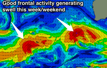
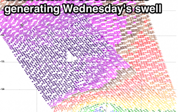
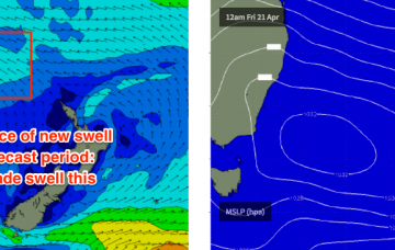
Our current long range E’ly swell is expected to continue motoring along into Tuesday, though a gradual easing will probably occur into the afternoon.
Large powerful SW groundswell tomorrow with morning offshore winds, less than perfect Wednesday. More large swell for Thursday and then Saturday with variable winds.
No let up in swell along with offshore winds for both coasts for the most part.
Great conditions most mornings this week with lots of swell to come. Work the size and conditions for the best results.
I am also expecting a new E’ly swell to build through Saturday - a very distant, infrequent E’ly pulse from a broad, complex system way out in the South Pacific earlier this week.
Fun easing E/SE swell tomorrow, small and very inconsistent into early next week.
Small clean W/SW swell tomorrow, with a larger stronger swell building Sunday. Large and powerful long-period W/SW groundswell for Wednesday.
The three-way merger in the southern Tasman Sea isn’t doing anything interesting from a synoptic perspective so the resulting southerly groundswell for the weekend won’t be anything amazing.
Large building swell tomorrow with S/SE winds, easing with better offshores Sunday morning. Larger SW swell for Tuesday but winds are dicey.
Good new W/SW swell tomorrow, followed by a SW groundswell Sunday afternoon. Clean conditions each morning, while next week a large and powerful SW groundswell will peak Wednesday as offshore winds continue.