Make the most of Saturday, it's looking small and windy beyond
Friday, 1 November 2024

Make the most of Saturday, it's looking small and windy beyond
Friday, 1 November 2024
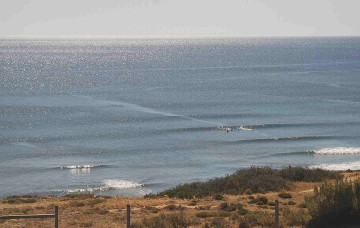
Saturday is your best chance for a wave this weekend.
Saturday is your best chance for a wave this weekend.
Surf size will ease into Saturday, and winds will freshen from the NE before tending N’ly through the day.
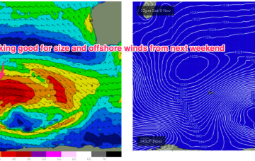
Next week still looks iffy for winds as a node of the long wave trough steers fronts into the SW while slow moving high pressure sits in the Central Indian Ocean. Those fronts will maintain a moderate sized series of SW pulses from Tues.
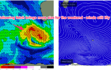
Saturday is your best chance for a wave this weekend. We've also got a solid swell for the start of next week.
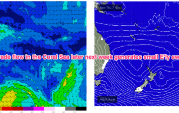
We should see a weak, E’ly trade flow develop across the Eastern extremity of the Coral Sea and into the South Pacific slot later next week which would see some background E swell start to fill in later next week.
The freshening N-NE flow along the NSW temperate coast should generate some NE windswell through Wed PM, peaking Thurs
A shallow troughy change Mon looks to stall south of the MNC on Mon. If that current outlook holds we’re looking at a working week of N’ly winds and patches of NE windswell.
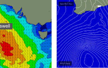
High pressure slides into the Tasman off the Central NSW coast while the remnants of a front scoot across the Tasman. The front will have generated a small flush of S swell.
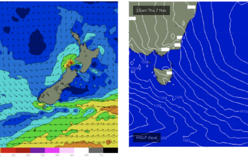
A gusty S/SW change is due into the South Arm around 7-8am Thursday (give or take) so any chances of surfing will need to happen at dawn.
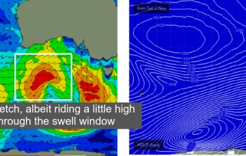
Next week looks little more active now as a fetch of SW gales over the weekend between 70-100E builds seas to 20ft.