Large swell today, easing into the rest of the week
Monday, 9 December 2024

Large swell today, easing into the rest of the week
Monday, 9 December 2024
Make the most of the current swell ahead of a poor weekend.
Make the most of the current swell ahead of a poor weekend.
A very weak troughy pattern is unfolding this week with a weak high pressure (1016hPa) cell moving into the Tasman today as a trough stalls about the Far North Coast. Another trough tomorrow brings a shallow S’ly change which again looks to stall out on the North Coast before another weak high cell moves into the Tasman late this week. In short, no major swells expected.
Conditions aren't as favourable for both coasts this period but decent swells will persist.
A very weak troughy pattern is unfolding this week with a weak high pressure (1016hPa) cell moving into the Tasman today as a trough stalls about the Far North Coast. Another trough tomorrow brings a shallow S’ly change which again looks to stall out on the North Coast before another weak high cell moves into the Tasman late this week. In short, no major swells expected.
Every morning looks clean with a stronger swell for later week.
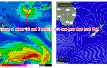
Weak high pressure in the Tasman is holding a very weak fetch of SE winds in the Coral Sea which is adding minor amounts of energy to a tradeswell on it’s last legs.
There’s really nothing of interest at all next week with surf remaining tiny right into next weekend.
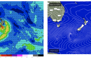
A passage of weak but favourable frontal system should generate small, fun surf from Sunday.
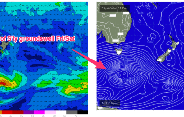
Today's swell will ease over the coming days ahead of a large, powerful groundswell early next week.
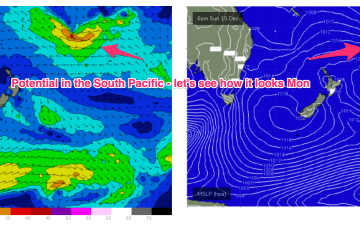
Longer term and we’ll be watching the South Pacific Convergence Zone for signs of low pressure development near Fiji later next week, possibly even retrograding back towards the Australian continent.