Good waves for the weekend and a sizey S swell for Xmas
Friday, 20 December 2024
Good waves for the weekend and a sizey S swell for Xmas
Friday, 20 December 2024
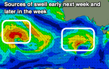
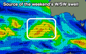
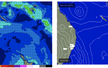
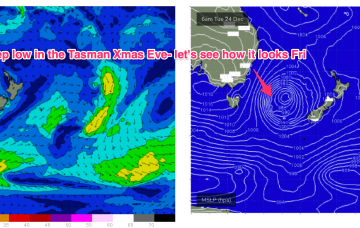
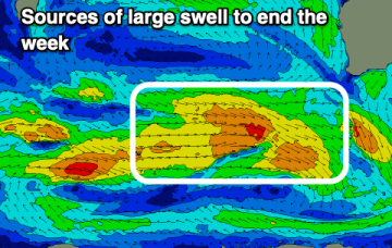
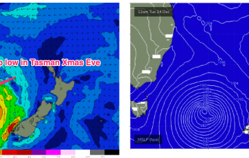
Current ASCAT (satellite windspeed) pass shows a Tasman low with a long fetch of strong S-S/SE winds well positioned in the swell window. Concurrently, weak high pressure is moving NE to be off the sub-tropical coast o/night and into tomorrow morning.