NE windswell for Boxing Day and Fri then not much to close out 2024
Wednesday, 25 December 2024
NE windswell for Boxing Day and Fri then not much to close out 2024
Wednesday, 25 December 2024
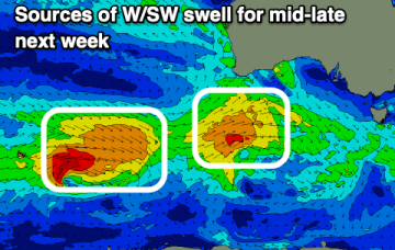
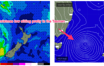
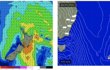
Elongated high pressure is moving into the Tasman with an approaching trough, front and cut-off low expected to tighten the pressure gradient leading to freshening N’lies from Boxing Day and some developing NE windswell.