Poor weekend, good swell next week aside from the winds
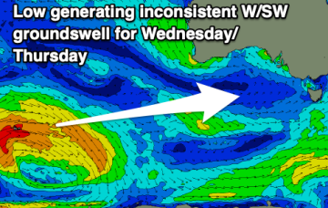
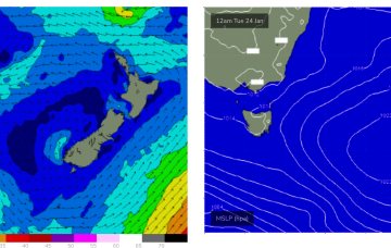
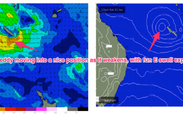
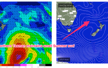
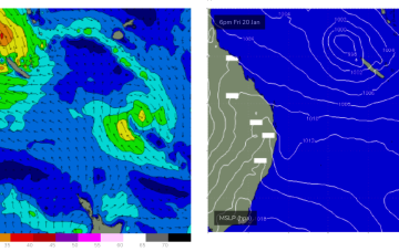
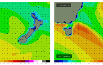
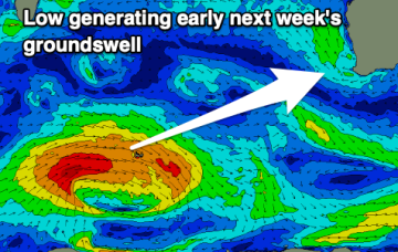
There's not much to chase on the weekend, while some better swell is due next week but with poor winds.
Poor surf is set to continue across the South Coast for the period, with one small window next week.
In the Coral Sea a depression on the end of the Monsoon Trough is organising with a high likelihood of forming a tropical cyclone (TC Freddy) - this is looking like a handy swell producer for the region although no real size is expected as the system weakens as the swell producing fetch moves into the swell window.
Not much surf expected over the weekend. Light winds are on offer so whatever surf you can find should be clean but absent any real swell sources we’re looking at some small S swell wrap with a few 2ft sets at S facing beaches Sat, easing back to tiny on Sun.
In the Coral Sea a depression on the end of the Monsoon Trough is organising with a high likelihood of forming a tropical cyclone (TC Freddy) - this is looking like a handy swell producer for sub-tropical areas although no real size is expected as the system weakens as the swell producing fetch moves into the swell window.
No great change to the weekend f/cast. The remnants of yesterdays troughy change are now lingering off the NSW North Coast and a weak high pressure ridge is maintaining a soft but persistent onshore flow along the Eastern Seaboard. Activity in the tropics has been intense but short-lived with TC Irene forming between New Caledonia and Vanuatu, now downgraded back to sub-tropical storm status and racing away to the SE (the grave-yard) without being a significant swell producer for the East Coast.
Mixed swells with a couple of windows for the beaches in between pulses.
No great change to the outlook with plenty of rideable surf expected. High pressure remains anchored in places at Tasmanian latitudes with reinforcing cells maintaining a high pressure ridge along the QLD coast. Abutting this ridge is a series of monsoonal lows, which are enhancing windspeeds through the CQ swell window.
Weak high pressure sits in the Tasman now, maintaining a NE flow across NETas as a trough and front approach from the W and SW, bringing a S’ly change today. S’ly winds and swell quickly build in the wake of the trough.
Poor surf tomorrow, easing Friday but cleaning up ahead of a good SW groundswell Saturday.