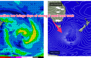
Water calibre low brings plenty of strong S swell beginning Sun
Friday, 1 March 2024

Water calibre low brings plenty of strong S swell beginning Sun
Friday, 1 March 2024
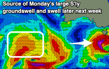
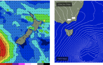
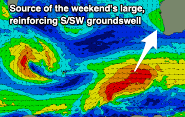
Models are holding steady on a winter calibre low tracking well to the south- south-east of Tasmania during Sun and traversing the far Southern Tasman through Mon.