Minor E'ly tradeswell should stop surf going flat later this week
Monday, 22 July 2024
Minor E'ly tradeswell should stop surf going flat later this week
Monday, 22 July 2024
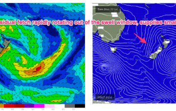
Following that we’ve got a spring like week ahead with only some minor E trade-swell to offer up some rideable waves.