Great run for the South Coast with a couple of Mid days
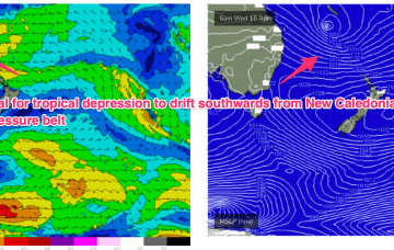
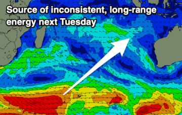
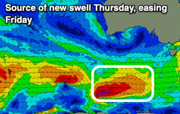
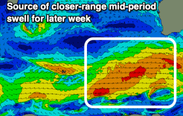
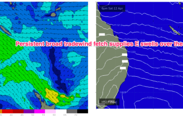
The coming outlook is great for the South Coast though the Mid Coast should offer a day or two of fun swell as well.
High pressure is moving into the Tasman, strengthening as it drifts towards New Zealand, where it is expected to become a dominant “flat topped” feature, reinforced by subsequent high pressure moving into the Tasman. We’ll see a long E’ly fetch develop through the South Pacific slot through the end of this week, enhanced by a trough of low pressure near New Caledonia which is attached to a still active monsoon trough.
The coming period provides more options to the east on the backside of the weekend's swell activity.
This week will be on the slow side, with building energy into the weekend.
There's plenty more swell on the way with favourable conditions for a wide selection of breaks.
The coming period isn't as reliable wind wise, though one window stands out.
High pressure is moving into the Tasman tomorrow in the wake of a front with a weak tradewind fetch and SE surge developing.
A front passes into the Tasman overnight and robust fetch of SW gales is trailing behind, currently sweeping NE past the SE coast of Tasmania. We’ll see a moderate S swell generated by this fetch, with a dominant high moving into the Tasman in it’s wake and strengthening through the week
A long E’ly fetch then develops in the South Pacific slot with the head of the fetch extending into the Coral Sea and Northern Tasman. E’ly swells from this source will initially favour the sub-tropics before filtering down into temperate NSW.
We've got favourable winds and plenty of swell due this week with some westerly energy due later week.