Stormy XL swell peaking late on Saturday
Friday, 20 May 2016
Stormy XL swell peaking late on Saturday
Friday, 20 May 2016
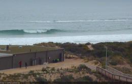
No shortage of swell over the weekend, but with virtually no quality.
No shortage of swell over the weekend, but with virtually no quality.
We’re still on track for some good southerly swell across the Northern NSW coast this weekend, but if you’re located north of the border, expect a disappointing round of surf once again.
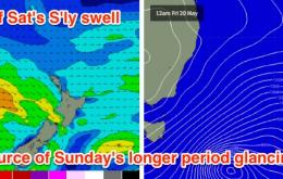
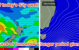
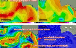
There’s a couple of components to the southerly swell unfolding across the East Coast.
Today’s swell is expected to drop steadily from tonight onwards, and northerly winds will freshen throughout Saturday as a dominant high pressure system moves slowly across the region.
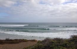
For the most part you’ll be surfing Friday's leftover groundswell over the weekend.
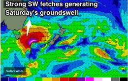
We are looking at a strong SW groundswell peaking on Saturday, hindered by strong and persistent onshore winds.
We’ve got more swell on the way.
We’re still in the midst of a particularly active autumnal Southern Ocean pattern, and gale warnings are out for the coast on Thursday.
Local frontal activity is set to continue, although this time with a pair of systems moving far enough to the south to provide a small amount of energy.
Solid pulse of S'ly swell due to peak on Saturday, with a second pulse mid-way through next week. Biggest across Northern NSW, not much for SE QLD.